Estitkw/Apodaca Escapade

July 19, 2026

I awoke unprompted by my alarm at 5:30AM. I showered, unplugged all the electronics that had been charging overnight and hit the road for Jericho Sailing Association. Since my seasonal parking pass doesn’t cover overnights in the Jericho lot, I parked a few blocks away, piled the last of my gear and the fresh food in the cart. (I’d prepositioned most of my gear inside my boat yesterday, when I’d been guiding and instructing for Jericho Beach Kayak).

With the help of the JBK rental staff, I launched my laden boat about 9:45AM. The headwinds were already rather stronger than predicted in yesterday’s forecast on windy.com, so it took me until 11AM to reach the second dolphin at the west end of Spanish Banks. From here, I aimed more-or-less towards Point Cowan on Bowen Island — more when a lull in the wind and/or breaking waves made it possible and safe to head northwestish, and less when I had to turn straight into spilling swells for stability. It required constant alertness to monitor and prepare for the next set of would-be kayak capsizers.
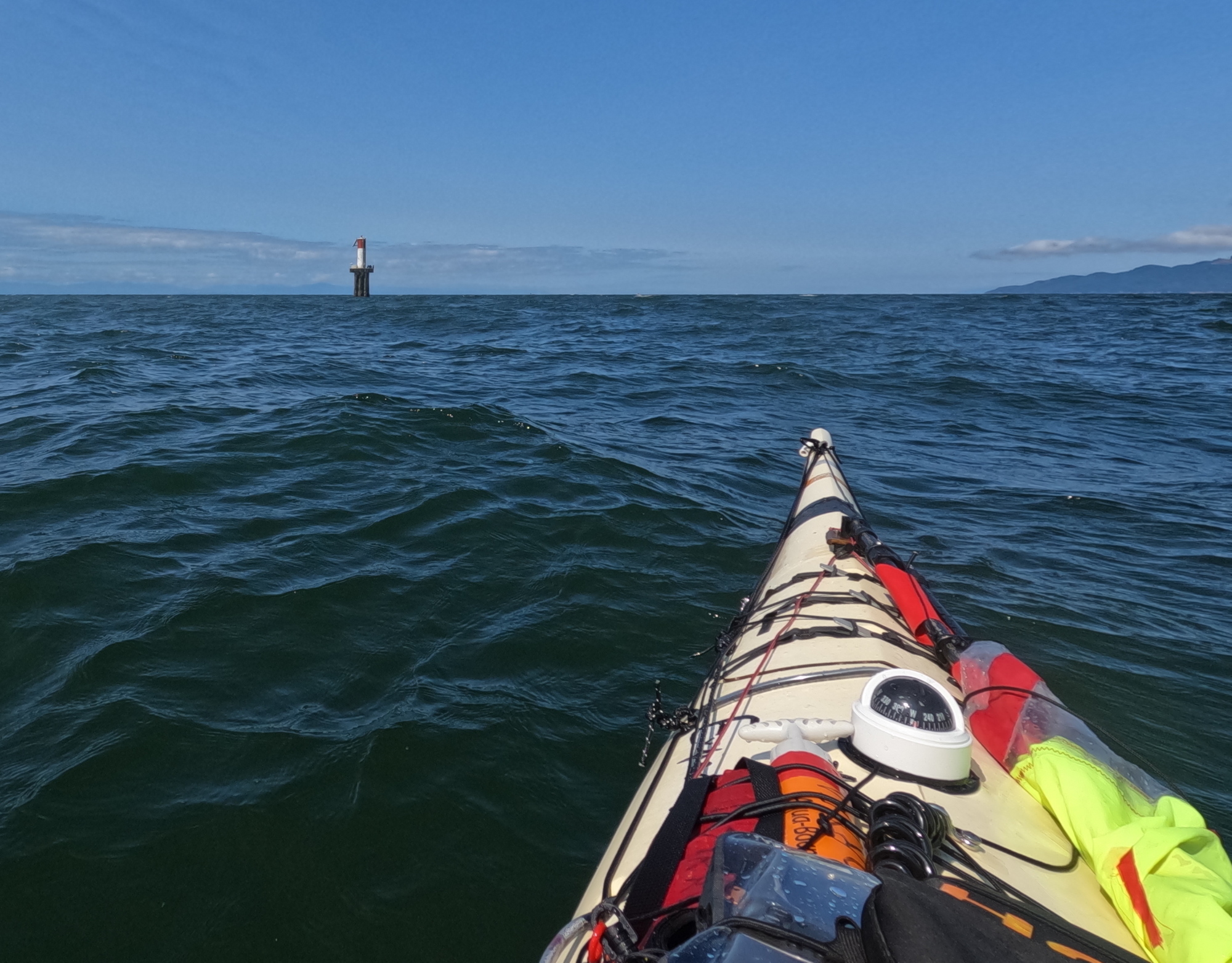
Approaching the second dolphin, west end of Spanish Banks, English Bay, Vancouver, BC

I cannot lie: there were a few times I was a bit nervous, and I used my braces “for real” more than once. But mostly it was a matter of (very) slow, steady plugging along. The seas were a sporty combination of swells, tastefully overlaid with wind waves, all set off beautifully with whitehorses and long streaks of white foam. 
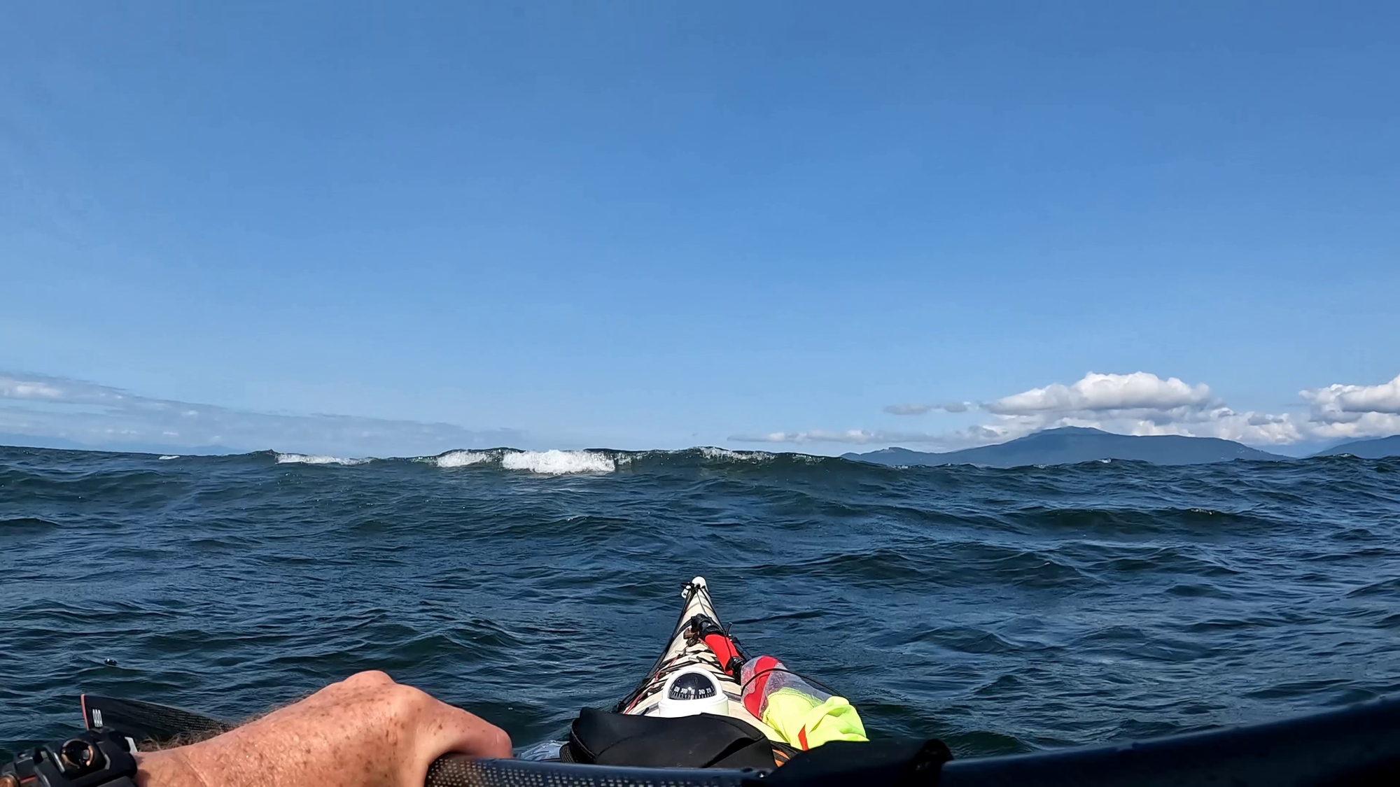
a sea kayaker's point of view of a breaking swell near the bow of the boat

Any tedium was relieved by two passenger fast catamarans (Hullo Ferry’s entire fleet) criss-crossing in front of me, Nanaimo and Vancouver bound respectively. Their wakes interacted in challengingly unpredictable ways with the swells and wind waves. So “Wakey! Wakey! Rise and brace!” Not long after this, an American sailing yacht actually detoured to pass close and check if I was OK. Nice of them.
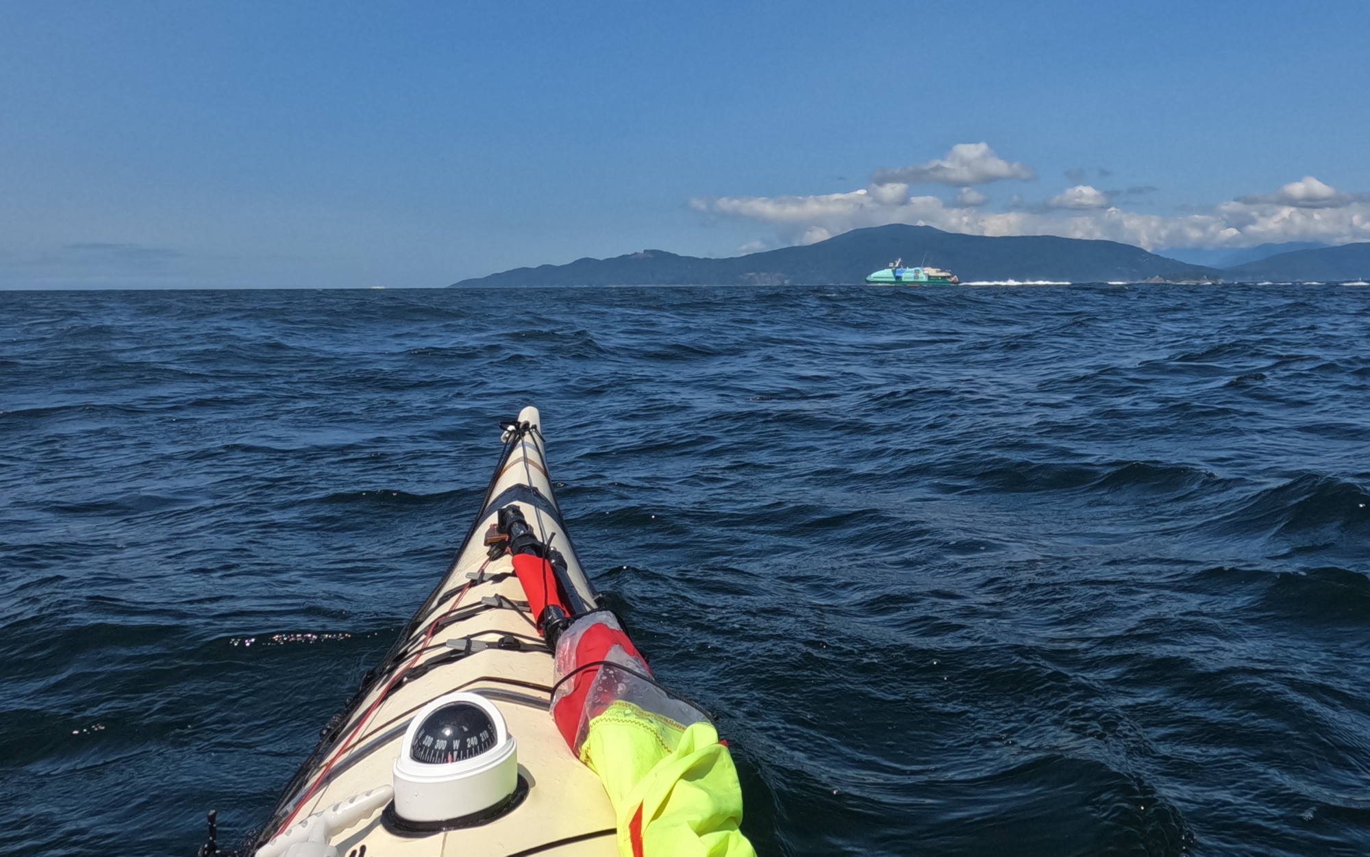
A high speed catamaran ferry generates spilling wake in front of a sea kayak.
Hullo Ferry; hello wake!

At one point, I had to surrender a fair bit of my hardwon progress, and swing down to a course toward Point Grey to ensure I would pass astern of a northbound freighter making its eastward arc into the Port Of Vancouver. Technically speaking I was at least a few hundred metres clear of the mouth of the inbound traffic lane marked on the charts, but I’m far too polite to make an issue of these kinds of things. Particularly with vessels that outweigh mine thousands to one.

As advertised in the Wildcoast Recreational Map (and my previous experience), the area southwest of Passage Island was rockin’ and rollin’ from the crashing currents of Howe Sound and English Bay, overlaid with the wind.

By midafternoon, I was rather thirsty and peckish. Fortunately, I had thoughtfully stowed a water bottle and snacks in my Northwater Underdeck Bag. Unfortunately, the deck of my sprayskirt was regularly awash with green water and I dared not pop the front open. Perhaps, like Paddington Bear, I should in future keep a marmalade sandwich under my hat “in case of need”.

Until now, I’d been navigating by chart, compass and Mark I eyeball, both as a matter of professional pride, and because constantly squinting at the screen of a GPS is a recipe for seasickness in big water. But now I fired it up to confirm the faint line through the trees I’d spotted on Bowen Island marked Optimist Creek leading down to Apodaca Cove. I was more than a little smug when the multi-million dollar satnav system agreed with me. 

On the downside, it was now after 15:00 hours and the GPS’s prediction was that with my current slow plod, I wouldn’t reach camp until 17:30ish. Faced with this, I seized upon a moderately mad plan: I was now slightly upwind of Apodaca. Did I dare raise my sail in winds and waves this big? I did so dare. To achieve a beam run made good, I actually needed to point slightly upwind. This put me effectively beam on to the swells and breaking waves. But I reckoned that with the forward drive from the sail, I could stick my Greenland paddle out at right angles to the kayak on the upwind side, and use it as a foiling outrigger. I’ve been doing this while kayak sailing for years, but these were among the most challenging conditions I’d attempted. But all went well: spilling swells at times buried the blade a foot or more underwater, but I simply angled the leading edge of the paddle until it flew back to the surface.

a wave breaks across the bow of a sea kayak sailing

The experience had a little bit of the mad exhilaration I’d always imagined for Ernest Shackleton’s party when they did their do-or-die sitting glissade down the mountains of South Georgia.

Having judo’ed the wind from enemy to ally, I rocked up at Apodaca at 16:15. Six and a half hours was the longest continuous stretch I’d spent in the cockpit in a long time, and the sea conditions were the most “technical” I’d paddled in quite a while (Paddle Canada Level 2 spilling over into Level 3 for those who know.) So while it had been hard work, there was satisfaction in knowing the ol’ bod still has it when needed. 
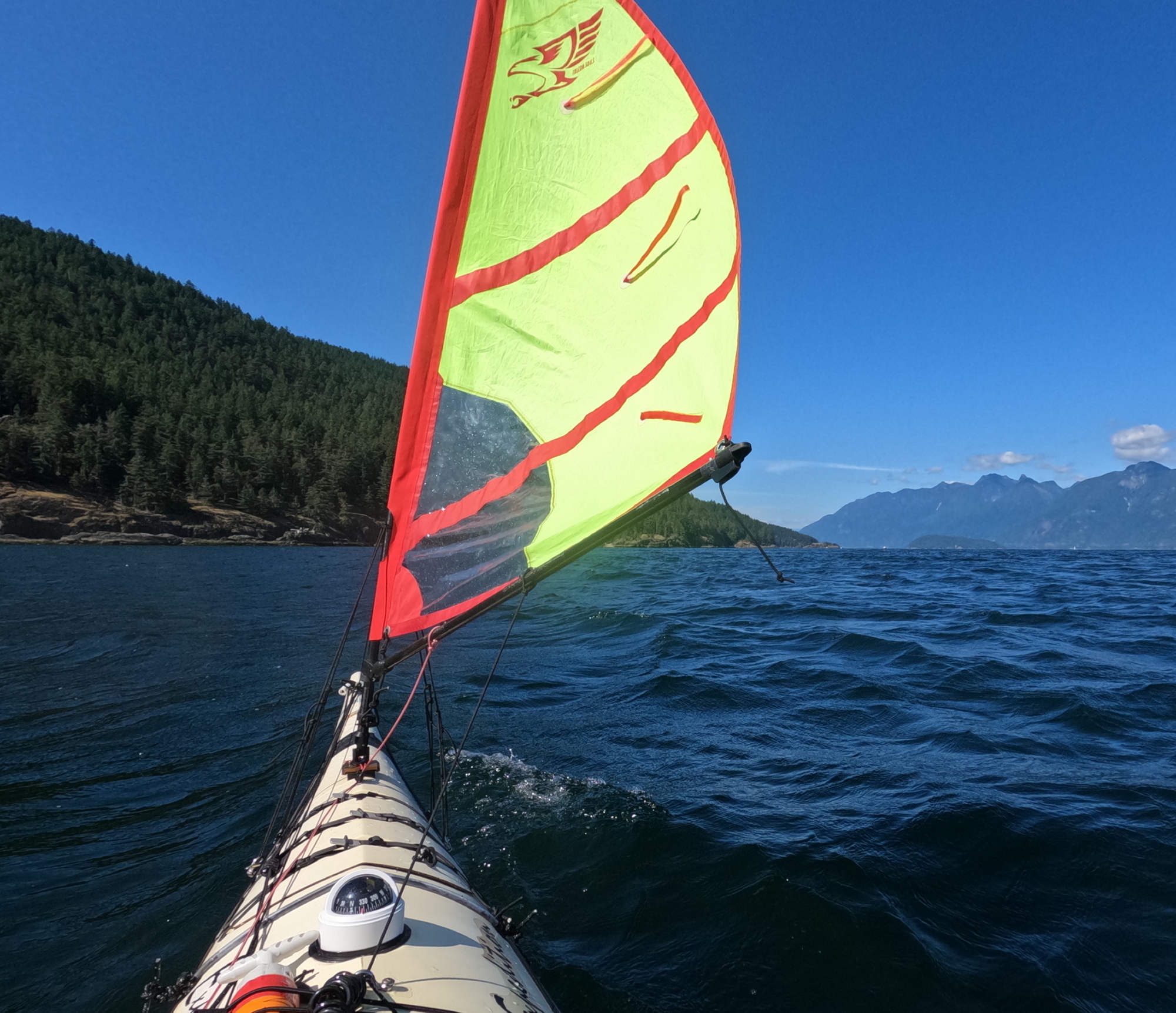
Apodaca Ho!

I bobbed a bit offshore of the beach for about ten minutes to let the wake from a passing BC ferry arrive and then disperse. The two rollers I’d homebrewed from wooden doweling sheathed in pool noodle foam made getting the loaded boat up the rocky beach much easier. There is a wooden kayak rack in the upland above the beach. But between the top of the beach and the rack is a gnarly barricade of tangled driftwood logs, as though a giant had been playing pick-up-sticks. I judged that solo portaging my boat across these multiple leg traps ran too high a risk of fracturing bones and/or boat, so I slid my craft as high up the logs as I could manage, then tied the bow off to a tree. 
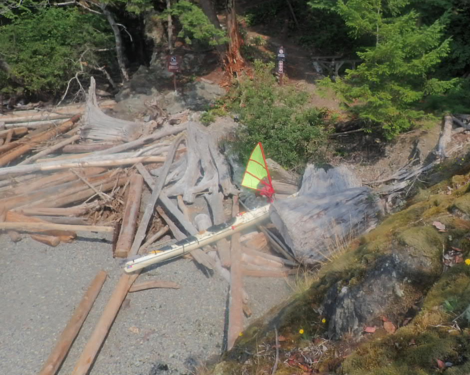
Landed at Apodaca. The (inaccessible) kayak rack is visible in the shadows to the right of the signpost.

The switchback path up to the tent platforms was rather steep, but the view from the camping area was amazing: Passage Island, the city, and Point Grey in one wonderful sprawling panorama. Per my recent practice on shorter trips, I’d grabbed a panful of food from the self-serve buffet at my local T&T market, and frozen it at home for my first night’s supper. So as I made camp, dinner was thawing and heating in my Outback Oven. There’s something deliciously decadent about having Chinese takeout–Spring Rolls, Sweet n’ Sour Pork, noodles and stir-fried veggies–in camp.

As I write this entry, I can still feel the roll of the swells in my balance system; I know from previous experience this will feel like being rocked in a cradle once I lay on my sleeping pad. Just as I was ready to abandon my folding armchair for bed, a pair of bats appeared in the twilight and put on a flitting skyshow for me.

July 20, 2026

I read only a few paragraphs of my book (Armada by John Stack) before falling into the sleep of the just (the just pleasantly exhausted…)

I awoke painlessly at 8AM. Down to the boat to retrieve my forgotten coffee mug. Last night’s high tide (probably aided by ferry wake) has rearranged the lower driftwood logs on the beach, and may make tomorrow’s launch trickier.

The plastic triglide on one of the front hatch cover straps has snapped off; I field repaired it by tying the strap off to one of the stay anchor padeyes for my Falcon Sail. I’m overall really pleased with how the front and rear compartment hatch covers did. There’s a bit of mild dampness in the stern compartment, but no full-on liquid water. Pretty impressive considering the long hours in breaking seas during yesterday’s crossing. I’m glad to have added a thin strip of neoprene gasketing to the inside of the stern hatch cover.

I breakfasted on canned hash, Starbucks instant coffee and eccles cake (leftover dessert from last night I was too stuffed to finish.) As I ate, I watched a hummingbird mistake my grey and red tent for an oversize flower. On the blue water below, pleasure craft and private fishing boats passed, showing (to me at least) that in many, if not most, humans, something in us yearns for the sea.
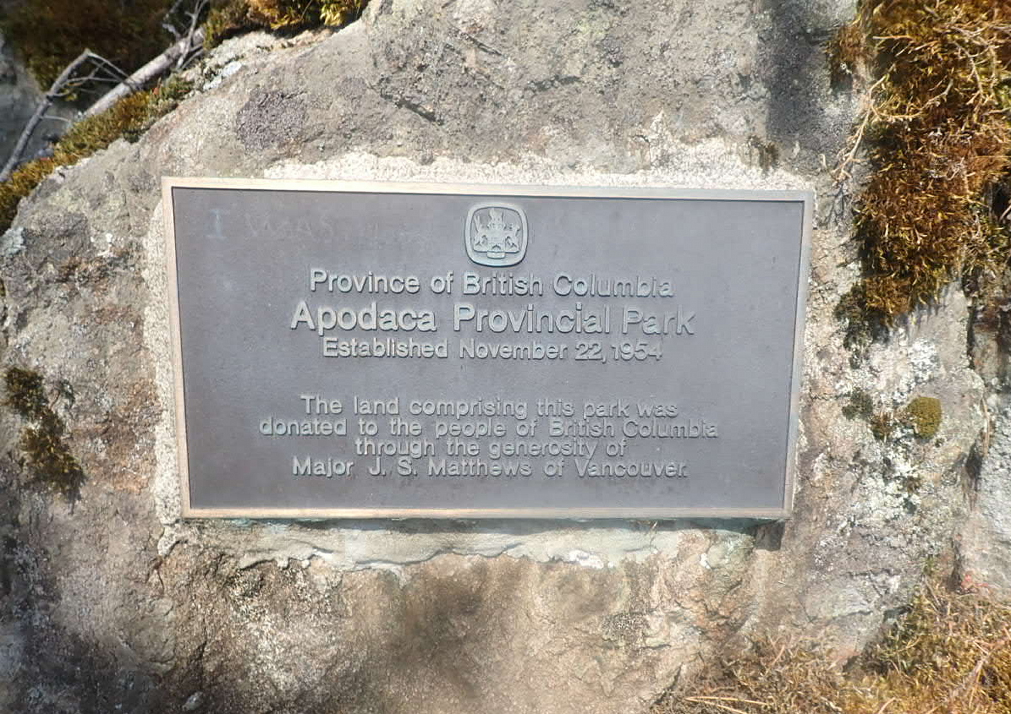
I’m glad to be taking what real athletes would term a “recovery day”. I take advantage of the flat tent platform to do some “prayer stretches” for the squished discs in my back.
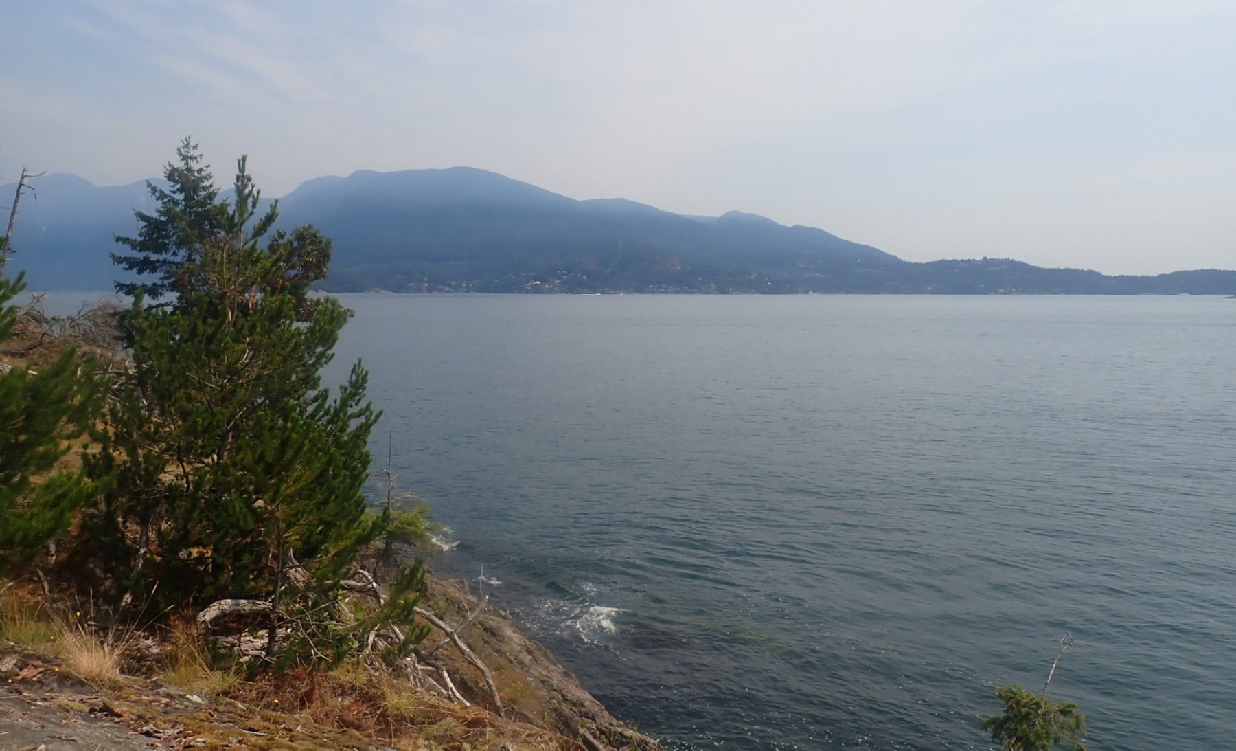
Looking to North Vancouver

After having cunningly rigged two perfect lines for my hammock, I discovered to my chagrin that I’d packed the bag containing the bug netting for the hammock, but not the hammock itself! So I’m having to rough it in my folding armchair, which I slowly migrate around the tent platform so it’s in the shade throughout the day.

I have a bit of sunburn on my forehead. I don’t usually apply sunscreen there as sweat tends to carry it into my eyes, inducing a tear-gas like effect. And usually the wide brim of my sunhat protects it. But yesterday’s prolonged upwind paddle kept pushing the hat back and exposing my brow. 

The seas appear teasingly calm in the lee of Bowen Island, but looking out into the Strait, I can make out white seas even with my naked eye.

The forecast is for light winds from the west tomorrow, so I think I will aim for the red buoy off Point Grey (which bears 127° magnetic from here), then hopefully broad reach back and forth under the sail back to Jericho.
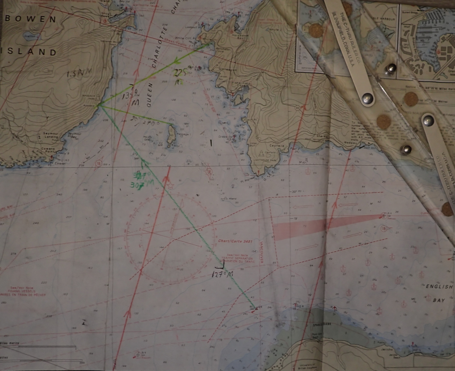
My chart for this trip, with some bearings and LOPs pre-marked for navigational convenience.

I’m enjoying drinking off the ice water from the cold packs in my cooler as they thaw. Very refreshing on a hot day. The interior of the cooler is still cold enough that I have no concerns about the food safety of tonight’s smokies inside.

The bugs were out more strongly tonight, and I could not locate the Bug Off I was sure I’d packed (PS: naturally, when I unpacked at home, I found it immediately.) So I retreated to the tent and hit the bed early. 
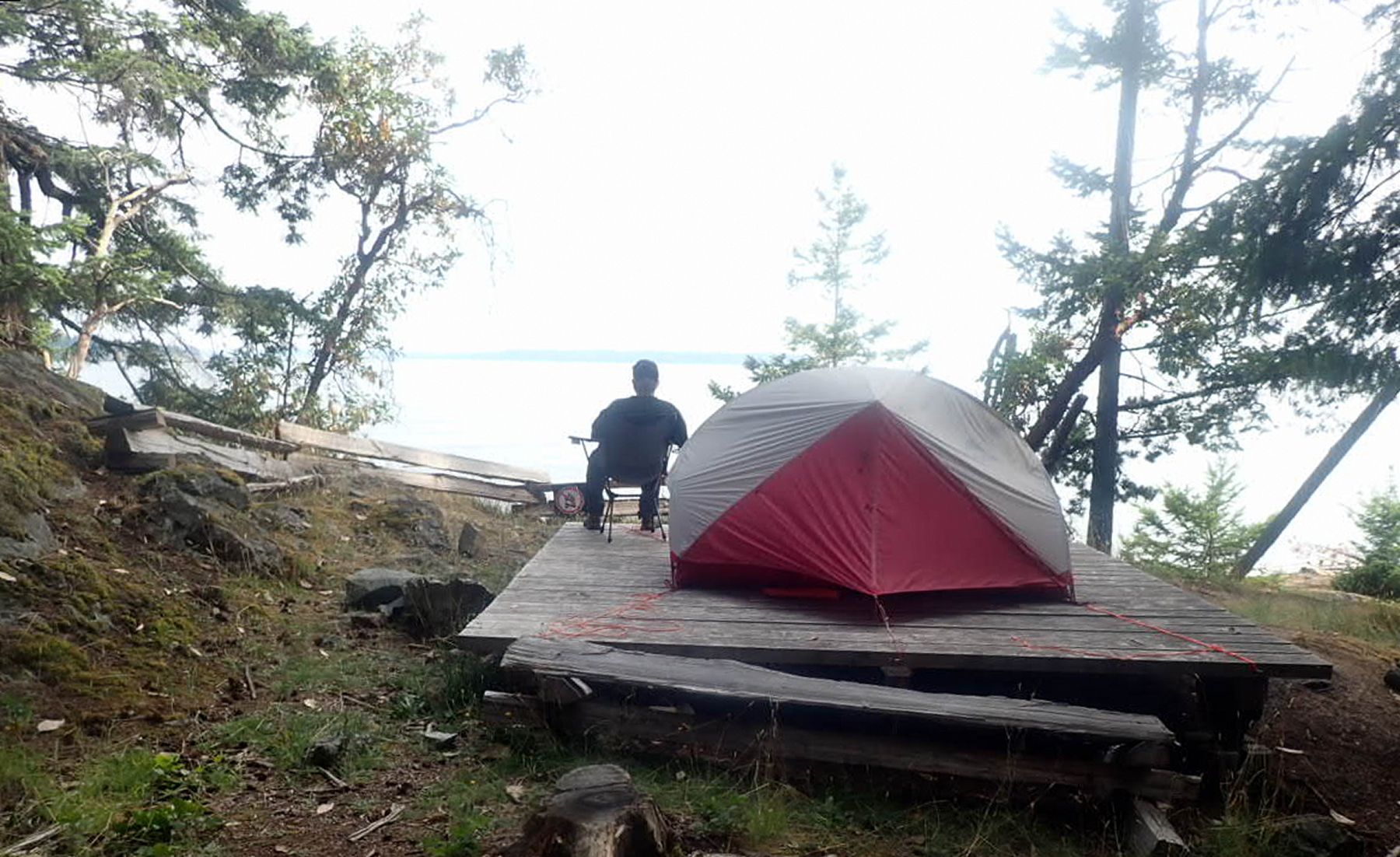
I woke up briefly in the night brooding about the shifted driftwood logs and ferry wake making the morning’s launch difficult and/or dangerous.

July 21, 2026

I’d set my alarm for 6AM, but woke up naturally at 5:30. So nice to break camp in the dry and in daylight. Instant oatmeal for breakfast. No coffee as I don’t know how long I’ll be in the boat this morning.

I skidded my boat back over the driftwood logs and launched safely at 8:30AM, par for my course of 3 hours from getting up to getting away. Wonderfully calm on launch – so nice staring down into the cool green depths.

I marked my southward progress by watching the south tower of the Lion’s Gate bridge (just visible through the distance and haze) migrate steadily from left to right of the Point Atkinson Lighthouse.
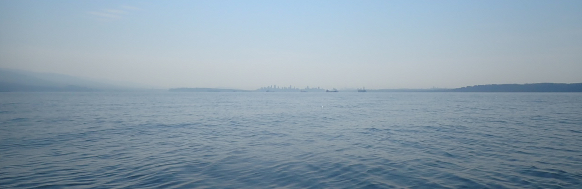
 From left to right: North Vancouver, First Narrows, Stanley Park, downtown Vancouver, Kitsilano, Point Grey
The hazy days of summer (forest fires). From left to right: North Vancouver, First Narrows, Stanley Park, downtown Vancouver, Kitsilano, Point Grey

My goal was to get far enough south far enough that by the time the morning inflow winds picked up, I’d be in the “suck zone” of English Bay rather than Howe Sound. At first, rising ripples on the sea’s surface weathervaned to me that I was still in the Howe Sound catchment area. Then, about an hour and a quarter after launch, the ripples shifted from coming dead ahead to on the starboard quarter; I’d hit the tipping point. Though the airs were still only very light, I raised the sail.

This screenshot was taken from another trip, but shows the boat and set-up I was using. Bowen Island is visible in the background.

Despite pointing my bow just east of Point Grey, the wind angle and a strong inflow tide swept me hard east, so that at times I had to paddle-sail to avoid hitting freighters rudely anchored in my path.

Once I reached the first (eastmost) dolphin off Spanish Banks, I was able to proceed on sail only the rest of the way to Jericho, landing at 11:30AM. Three hours home vs. six and a half on the way out. I’d earned my fish n’ chips at The Galley.


Rooms With A View: The Basics Of Tarpology

If you’re sea kayak touring in British Columbia, and out for any length of time, it’s not a matter of if it will rain, but when it will rain. They don’t call it “The Wet Coast” for nothing. In such Noahscape situations, being able to rig a secure kitchen-dining shelter is essential to ward off both cold and cabin fever.   

Showing a camp tarp rigged in an A-frame configuration
The classic A-frame bungalow roof tarp configuration, with an end pole improvised from driftwood.
Read more: Rooms With A View: The Basics Of Tarpology

Materials

If you only camp very occasionally, even the basic “plastic” tarps from your local Crappy Tire or Home Depot will suffice. They will be bulky and not terribly durable — though pinholes are easily fixed with duct tape. Please don’t let their semi-disposable price point tempt you to abandon them in the field at the end of your trip. Blue is the most commonly available colour, but if you can find orange, it provides a more cheery ceiling in the rain (this is true of all tarps: yellow and orange fabrics create a gloom-dispelling faux-sunlit vibe even on cloudy days.)

Polyester (PU) coated fabric tarps are more durable and compact, and, predictably, more expensive.

The most compact of all tarps are made with silicone-coated fabrics. (I fondly remember field-testing a prototype tarp for my erstwhile outdoor retailer employer decades back, before silicone fabrics were common. I wound up sharing a backcountry campsite with a friendly father and son. Their astonishment when I conjured an 8’ x 10’ tarp out of a soda-can sized stuffsack was as if I had produced not a rabbit, but an elephant, out of a hat.)
Silicone fabrics are also highly stuffable, saving a lot of time with folding and rolling.

Shapes

Several companies make cunningly-tailored wing tarps. I’ve owned a couple and really loved the catenary-cut, sag-defeating ridgeline and the assured-drainage scalloped edges. I was less enamored of the single set-up option. Particularly at improvised sites deep in the backcountry, vegetation often rudely insists on growing exactly where you need the edges of the wing to be. So these days, I carry rectangular or square tarps. They take a bit more rigor in rigging to prevent pooling water, but are more adaptable to cramped and oddly-shaped sites. 

Lines

When it comes to rope, the rule is: it’s hard to have too much. I typically carry at least a couple of hundred feet of paracord, in hanks of about 20 feet. The more line you have, the more options you have for set-up. By splicing one hank to another with a square knot, you can anchor lines to remote branches, trunks and roots. 

Showing a tarp rigged with very long lines, anchored to rock and trees up to a hundred feet away.
Playing the long (line) game. Having plenty of cord lets you float your tarp pretty much wherever you want it, even when natural anchor points are not nearby.

Brightly coloured lines will reduce stumbles and self-strangulation as you walk under and out from your roof. You can even buy reflective cord, which shows up beautifully in headlamps, and makes an excellent navigation beacon if you’ve wandered far into the bush to answer nature’s call at night.

Rigging Your Roof

If you’re setting up the classic A-frame bungalow roof configuration, you typically start by rigging the two high points that will form the ends of the tarp’s ridge, then adding the side and corner lines. 

Some folks like to do this by rigging a literal ridgeline —  a thicker rope running between two trees and/or poles. Next, they drape the tarp over this line, and use short lengths of cord wrapped in prusik knots (see below) around the ridgeline and secured to tabs or grommets on the tarp to stretch it along the ridgeline. This creates a very strong structure, but with the downside that the ridgeline rope chafing against the tarp may eventually wear the waterproof coating and/or the fabric itself to the point that it leaks. And dead centre of your roof ain’t a great place for leaks. 

Showing the A-frame configuration of a tarp without the use of poles
Look mah! No poles! The classic A-frame roof made by suspension only.

So for chafety reasons, I usually opt to simply stretch out the two attachment points at either end of the tarp’s centreline, letting the tensioned fabric itself create the ridge. Separate-ridgeline-rope enthusiasts will sneer that this stresses the fabric of the tarp more and is a weaker structure in wind. They are not wrong. But, tocca ferro, in decades of touring, I haven’t had a tarp tear yet. This might be because I retire my tarps (or demote them to “windbreaks only” duty) once the waterproofing has worn out, and this typically occurs long before the fabric itself is brittle. 

If you’re at a site that doesn’t accommodate retangular, symmetrical roof sides, think outside the box: make the diagonally opposite tarp corners the ends of your ridge, so the sloped sides become asymmetrical triangles that can poke between barricading trees and bushes.     

Showing a tarp rigged with an interior pole.
The high centre(ish) point setup. The tip of the pole is covered with a stuffsack to reduce chafe on the tarp.

Another classic tarp configuration is the high centre point, with the sides sloping down to form a shallow (and not necessarily symmetrical) pyramid. You can raise that centre point from the inside or the outside. From the inside, it’s via a pole of some kind, store-bought or improvised from driftwood. Either way, the tip where the pole makes contact with the tarp fabric should be condomized with a stuffsack to reduce chafe.

showing a kitchen tarp rigged with a centre pole made from a driftwood log
A driftwood log, upended and with the low end buried deep in the sand, makes a secure centre pole for this cozy camp kitchen.

Raising the centre point from the outside maximizes usable interior space. If there’s a cooperatively placed branch above the tarp site, just sling a line over it, tie it off to the topside tarp tab, then hoist the far end of the line and tie it off to a tree trunk or branch. (Your D.O.T. mandated “buoyant heaving line” works a treat for this.) 

a tarp suspended pyramid-style over the vestibules of two tents.
Centre-suspended pyramid configuration. Hanging from an overhead branch, this tarp forms a rain-free “mud room” for both tents.

If there’s no handy overhead branch, run a line from tree to tree above the tarp, then attach a prusik knot to this line and hence to the topside tab. This way, you’ll be able to slide the attachment point along the high line to fine-tune the tarp’s position. 

The blue line runs above this tarp from tree to tree. It’s connected to the topside tarp anchor point with a short, separate piece of cord wrapped into a prusik knot.

At breezy kitchen sites, you’ll want to rig the tarp as a combination windbreak and roof, with one edge at ground level. This will block wind-blown rain and keep gusts from wicking heat away from you and your camp stove. Some folks just rig their tarp as a simple lean-to, but these flat surfaces are prone to inverting into a sail when hit by strong wind. So I prefer to do a sort of pyramid tilted on one side. With the tip of the pyramid pointed into the wind and anchored securely, the tarp is much more aerodynamic and wind shedding.

Showing a tarp rigged as a leanto windbreak.
The “tilted pyramid” windbreak configuration. On the outside of the black patch above my head, a line runs to the tree branch beyond, preventing the tarp from inverting when wind hits the far side.

Though I do carry a few pegs for my tarp lines, I generally prefer to tie the lines off to tree branches, driftwood logs or roots. Natural anchors are usually more secure than pegs.

To minimize wrinkles and maximize drainage, try to run the lines from the side of your tarp as close as possible to 90 degrees away from the centre ridgeline, and corner lines out at roughly 45 degrees. Where lack of anchor points or the presence of obstacles prevents running a single line at the optimum angle, attach two lines to a single tab or grommet, run them out to whatever anchors are available, and tension them differentially to rid the tarp of ruckles.

As anyone who’s ever schlepped even a 5-litre waterbag knows, it doesn’t take a vast volume of water to be seriously heavy. So you want to ensure your tarp setup won’t trap large rainpools, lest there be rending of fabric and gnashing of teeth. Preventing pooling isn’t always a matter of going higher with your tarp lines or steeper with your tarp slopes. Sometimes it’s as simple as creating drainage valleys at the lower edges of your tarp. Do this by suspending a light weight, such as a water bottle, stuff sack with pebbles, or small piece of driftwood from one of the grommets or tabs.   

Knots

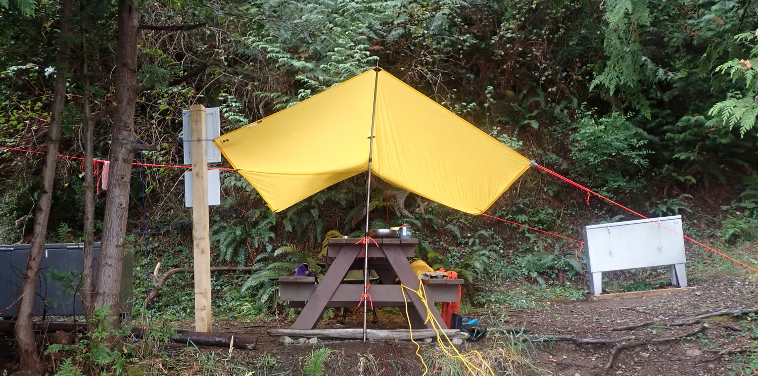
I have a pretty basic repertoire of knots that I mix-n-match as needed for rigging. The trucker’s hitch lets you apply a lot of tension to a line easily, so I tend to use it for the ends of the ridge attachment points, or for a tree-to-tree line that I’m going use a prusik hitch to suspend the topside attachment point from to form a high centre point pyramid. For the side or corner lines a tautline hitch usually provides enough tension. A simple square knot is great for splicing lines together to extend your anchor options. In the photo below, I used a pair of Japanese square lashings to secure the tarp pole vertically against the end of the picnic table. You can also use a square lashing to attach the ends of driftwood poles together to form an A-frame for one end of your tarp. 

Poles

If you can find one of suitable size on site, driftwood poles are an excellent option: they’re free, fully biodegradable, and take up no room in your boat. That said, I often carry at least one tarp pole for convenience and assurance I’ll have the right pole for my needs. I find the fully-telescoping type is easy to stow against the keel line of my kayak, but its minimum collapsed length is a few feet. If you have tighter hatches, you might need poles that fold tent pole style to fit through them.  

Tarps For Tents

Even if your tent’s fly is reliably waterproof, there are several reasons you might want an over tarp for it, especially on extended tours in persistent rain: 

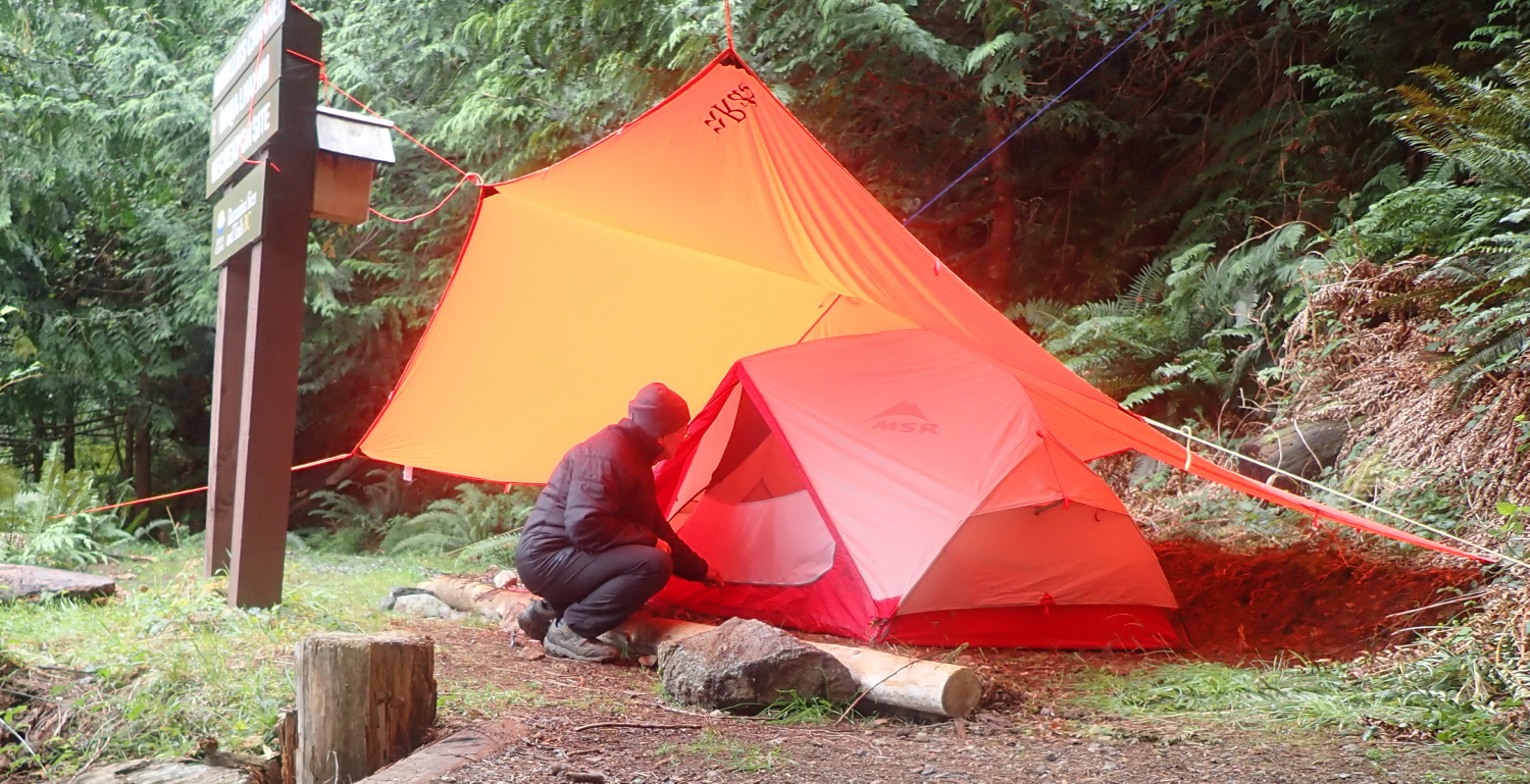
Firstly, it’s wonderful to have a dry porch roof/mudroom where you can stand up to doff and don wetwear without getting the tent interior soggy. 

Secondly, in seriously heavy rain–the sort that hammers down in dollops rather than drops–bedtime in an unshielded tent can be like trying to sleep inside a drum at a heavy-metal concert. Intercepting the rain a foot or two above the fly dials down the din from crazy-making to practically cozy. 

Thirdly, like me, you may well be fond of breathing right through the night. Each of your hundreds of exhalations contains water vapour. The cooler and wetter your tent fly is on the outside, the more of that breath vapour will condense against its inside. Wet begets wet. In a really prolonged rain in cooler weather, so much breath moisture can condense against a fly’s interior that it looks–and feels–as though the fly is leaking. By keeping the outside of the fly dryer, an over tarp will vastly reduce this effect.  

Finally, by rigging the over tarp first and taking it down last, you can set up and pack up your tent out of the rain, and keep the interior canopy dry. Or at least dryish.        

Four Day Getaway: An Escape To Átl’ka7tsem/Txwnéwu7ts (Howe Sound)

Prologue: this spring, I scored an ancient Current Designs Expedition kayak at the Jericho Sailing Association’s bailiff’s sale (where they auction off boats that have not had the storage fees paid in a while.) For the princely sum of $240, I got a 1992 boat, old enough that it had been made in British Columbia, before Current Designs was sold to an American company and the manufacturing moved out of BC.

Obviously, a boat that old was a fixer-upper, and I did spend a fair bit of time patching gouges, swapping out the sliding footpedals and guillotine-like aluminum rudder blade for gas pedal pegs and a light, low-drag SmartTrack rudder blade. I also added sail mounts and found a deck compass that could be modified to fit the existing base from the long-lost original compass.

After sea trials to confirm the boat would float (and sail!), it was time to take it on a multi-day voyage. 

September 21, 2024

I intentionally arrived at my put-in at Xwawchayay/Porteau Cove in mid afternoon, so that by the time I launched the afternoon inflow winds would be tapering off.

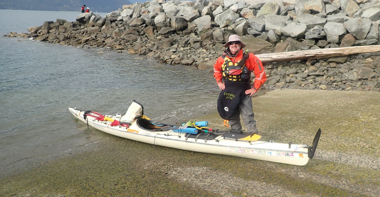
As I packed, one of the onlooking tourists wandered up to me and shot off a long paragraph in what I recognized as German. I had to tell her in English that I didn’t speak German. She switched to English. Her confusion had come from the fact that the spare paddle halves on my kayak deck were clearly labeled “Werner”. But that’s a brand name, not my name. I conscripted her husband to take a prelaunch photo of me, and exhausted my entire German vocabulary to thank him: “Das is gut, donkey-shine!”

ready to launch my sea kayak at Porteau Cove, British Columbia
Out To Launch

I also briefly puzzled them by soaking down in the outdoor diver’s shower just before stepping into the boat (it was so I wouldn’t overheat in my drysuit on this sunny, warm afternoon.)

I launched just before 4PM. The fully loaded boat punched easily through the oncoming waves, scattering sun-silvered droplets across my bow. I was fighting the tail end of the inflow wind. As hoped, as I approached the southern tip of Lhaxwm/Anvil Island, the wind eased.

paddling South down Howe Sound, British Columbia

I had the golden hour pre-dusk light bathing Christie Islet as I crossed Ramilles Channel to Gambier Island. I landed at the Inaka Lhaxwm/ Ramilles Channel Recreation Site just before 7PM, to find two other paddlers already in residence. They had, naturally enough, taken the primo tent site with a large flat pad. Since I knew from talking with them they’d be leaving the next day, I set up my tent on a rather lumpy section of the path. 

Because I was on a shorter trip, I’d tried something different for my first night supper: a few days before the trip, I’d hit the Chinese takeout buffet at our local T &T market, and filled a container with a selection of my favorites. I’d frozen the container at home and kept it in a cooler bag in my car until just before launching, so it stayed safely cool until I reached camp. As I set up my tent, I reheated my supper in my Outback Oven (a great outdoor cooking gadget that is sadly no longer made.) A delicious novelty to be feasting on Chinese buffet in camp, especially those crispy spring rolls. 

Moderate alarms and excursions in the night. I’d been reading in bed, and initially attributed the slight twitches on my legs to muscle spasms. They turned out to be a small mouse scampering over me in search of the egress. After an exclamation (which it turned out was loud enough for my site mates to have heard), I evicted him. I’m sure we both slept better for it.

After that, I slept well, occasionally catching traffic noises from the Sea-To-Sky highway a few miles to the east.

September 22, 2024

In conversation with my two site mates over coffee, it came out that one of them has taken several courses from my employer, Jericho Beach Kayak, from fellow instructors I know well.

As they launched for their trip back to Lions Bay, I took a few photos to email them later (I know from experience it’s always nice to have pictures that include you taken from a bit further away than arm’s length.)

two sea kayakers in Howe Sound, British Columbia, with Anvil Island in the background


As soon as they had packed up their tent, I pounced on the primo pad for a property upgrade, literally leveling up from my lumpy site of the night before. I spent a happy hour cunningly rigging a super cozy campsite with a tarp over my tent (so nice to have a full porch in front of the tent where you can kneel out of the rain while entering or exiting). I also rigged a large tarp over the picnic table. Thanks to having brought a telescoping tarp pole, I was able to rig the seaside axis of this tarp in a high A-frame, giving me a million dollar view of Ramillies Channel and Anvil Island through the cedar branches. Whether by accident or design, the table is positioned so those trees conceal the cottages on Anvil Island. And the now steady rain created white noise (or perhaps wet noise), drowning out any traffic noises. The two effects combined to create at least the illusion of deep wilderness. Very cool, especially just an hour’s drive from downtown Vancouver.

a tent with a sheltering overtarp to reduce internal condensation
a view of Anvil Island, Howe Sound, British Columbia, from under a tarp on Gambier Island


With a good morning’s work of homesteading done, I settled down to enjoy a brunch of tinned hash and buttered bagel.

As I heated up water for an apres-brunch shower, an open aluminum skiff drifted into view a couple of hundred metres away, with a pair of fishers trolling their rods. Funny how your outlook on exposure changes with age. A half a lifetime ago, when I actually had a body worth ogling, I was pretty self-conscious about it. Today, my take is that if someone is so deprived of stimulation that the sight of my pudgy pink body in the distance is enough to drive them into some sort of erotic frenzy, it would be almost unkind to deprive them of this outlet. So I showered in full view without shyness. 

Since there seemed little likelihood of much sunshine–and this site is in the shade much of the time anyway–I set up my candle-powered clothes dryer in the tent. This is basically a three candle lantern, set carefully far enough below the tent gear loft not to melt or burn clothing. I then stacked my drysuit liner in the loft, so the rising hot air would dry it and save me having to climb into clammy layers next time I wore it. 


I set out my wok to collect rainwater draining off the tarp. I’d be leery of using tarp run-off for cooking or drinking, but I know from experience it will be fine for washing dishes or self.

In addition to my food, I’ve got my drysuit stored in the critter-proof aluminum cache. Nice to know it’s out of reach of salt-seeking rodents. (Years ago, I had the sweat-seasoned armpits chewed out of a doffed and inverted paddling jacket by mice in the time it took me to eat lunch.)

I spend the rest of the afternoon reading and zoning into that lovely zen state where what Buddists call “the chattering monkey” finally shuts up. 

My book is The Ancestor’s Tale, by Richard Dawkins and Yan Wong. It’s a revised edition of the book I read years ago on a circumnavigation of Princess Royal Island.

I supped on tinned beans and molasses. With plenty of rainwater and fuel available, I was able to give the dishes a thorough wash, and not the mere lick-and-a-promise of typical camp cleaning.

I am being buzzed by the occasional mosquito. My mild annoyance is tempered with gratitude that it’s warm enough this late in the season for them to be conducting flight operations.

September 23, 2024

I awoke to low cloud, steady rain and limited visibility. Anvil Island is only a faint shadow looming through the rain. If this persists tomorrow, there won’t be the strong Northbound inflow wind typical of sunny days, and I won’t get my hoped-for glorious free ride back to Porteau Cove, courtesy of my sails. On the plus side, the water would be calm. Navigation would be no problem: in addition to my GPS, I’ve got a hiker’s compass, deck compass and a chart with many of the crossings pre-plotted. I’d aim for Anvil Island, follow its eastern shore to the northern tip, then paddle a compass course aiming off so I’d hit the east shore of Howe Sound south of Porteau Cove, turn left to go North and handrail along the shore to the Cove. 

I’m very glad of my folding travel chair. It’s much more comfortable for my not-fully-evolved-for-bipedalism back than the unsupportive bench of the picnic table would be. As always, I’m also happy to have brought what some would have considered a rather selfishly oversized tarp for a solo camper. But on rainy days like these, it’s nice not to have to crouch and prowl under a low, tiny roof. Instead, I have a high ceiling with plenty of head room, and a rain-free area that’s about equivalent to a reasonably-sized room at home. The tarp’s translucent yellow colour creates a warm, vaguely sunlit feel beneath it even on dark days. Add unlimited stove fuel, herbal tea and a good book, and it’s all very cosy.

As I fried up my brunch of pancakes and bacon, I flashed back more than half a century to (under)cooking fatty bacon purloined from mom’s fridge on top of a hobo stove. I’d made this chimney-like contraption out of a large apple juice can following directions from Boy’s Life magazine. It’s a surprise I didn’t die from trichinosis, taking my too-trusting younger sister with me.

There are lulls in the rain during the afternoon. I take advantage of them to explore the site a bit more, finding a second tent pad further in the trees along the path to the east (it would have been too much in the personal space of my site mates to have pitched my tent there on the first night.) Further east still, there’s a beach-access-only site. I’d already noted another cleared site just below the outhouse, but that would be a last resort only option for me: it’s up a steep and slippery climb, which would be even more awkward when portaging gear. Plus, who wants to be serenaded by the sounds of their site mates’ bodily functions in the night?

Although I have other options in my larder, I opt for quick, easy and spicy Korean ramen noodles for supper, with a fruit cup cocktail for dessert to ward off scurvy.  

a spider's web, backlit, with a sea kayak visible on the beach behind it

Shades of Robert The Bruce, I fall into a reverie watching a spider whose web hangs off tree branches just beyond my tarp. He’s been patiently sitting in the centre of his web all day. More insects are buzzing about in the gloaming, and soon a hapless fly hits the trap. The spider instantly scuttles towards its victim. We need to avoid anthropomorphizing other animals, but I can’t help but wonder if insects feel something akin to terror when caught like that? Obviously, they wouldn’t experience the full gamut of human emotions, but neither can they be merely the Cartesian automata that ol’ René imagined. But just where on the continuum would they fall?

a tent and its covering tarp glow from the internal light

September 24, 2024

a foggy beach on Gambier Island, British Columbia, with Anvil Island faintly visible in the background

Heavy rains in the night, but I awake to blue sky visible above a low fog. Confident it will burn off, I take my time breakfasting and breaking camp, and launch a bit after 11AM. With visibility now clear, I opt for a dogleg detour to check out Christie Islet. As a Migratory Bird Sanctuary, off limits to boat landings, it swarms with seagulls, cormorants, and seals.

cormorants on the cliffs of Christie Islet, British Columbia

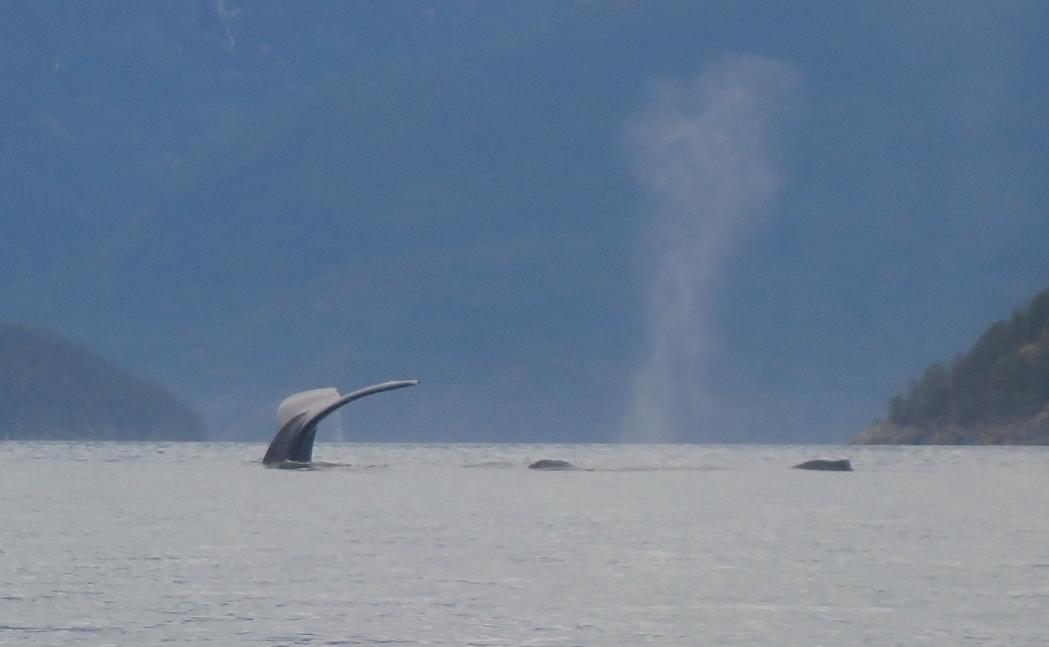
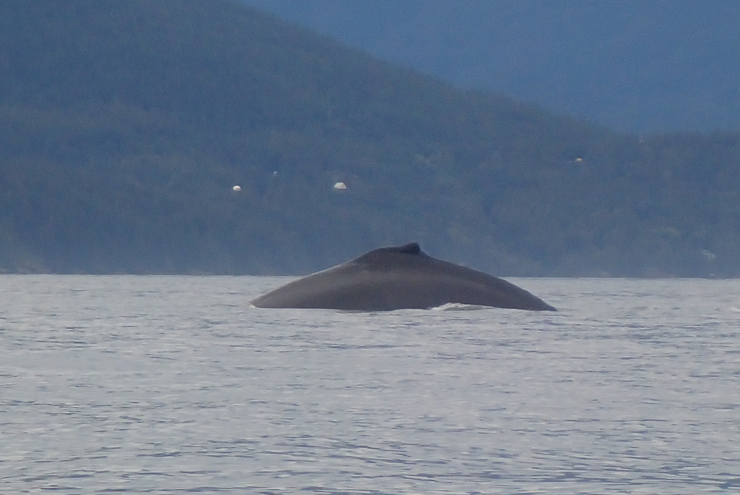
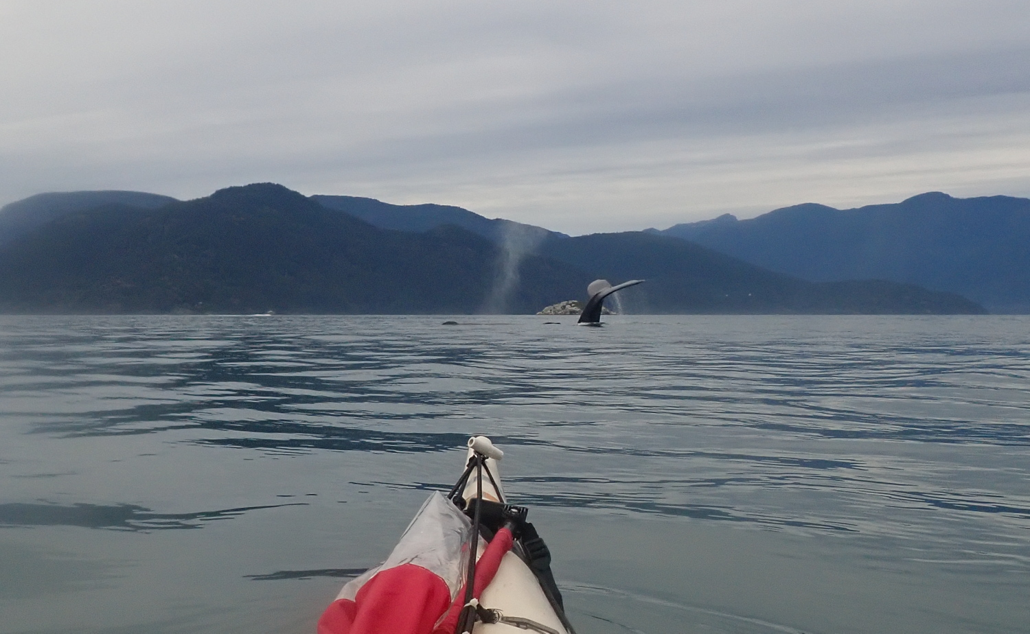
Turning north, I briefly put up my forward, Pacific Action sail. But though I am filled with hope, it is not filled with wind. I am reduced to actually having to paddle my kayak again. The horror! The horror! But I’ll soon be amply recompensed for this loss. As I’d been admiring the birds on Christie, I’d noticed out of the corner of my eye a jetski stopping in the middle of Montagu Channel, north of me. I’d wondered if they’d had a breakdown. As I altered course to swing close and offer to use my marine VHF to call for assistance if they needed it, I discovered the real reason they were stopped: a mother humpback whale and her calf were putting on an amazing show of synchronized swimming, plunging deep, under long enough that they must have been feeding on the seafloor more than two hundred metres below, surfacing with loud huffs and vast plumes of steam, and repeating the process as soon as they’d caught their breath. 

the tail of a diving Humback whale, with her calves visible on the surface behind her. Howe Sound, British Columbia

The jetski leaves soon after, but I stay, entranced. An occasional other boat joins me, grabs their requisite social media selfies, then zooms away. But everytime I try to get out, those whales pull me back in. I linger for about two hours, paddling a bit north, drifting south again as I stop to watch them surface, rinsing and repeating. It was magical, visiting with my cousins a few tens of millions of years removed.

a Humpback whale prepares to dive. Howe Sound, British Columbia'
The arc of a diver: moma Humpback prepares to sound
Humpback whales in Howe Sound, British Columbia

Eventually, I did have to go. I even got to paddle sail for a short while. And I approached Brunswick Point, more whales! Too far away for worthwhile photos, though.

By now it was late afternoon, and the need to pump my personal bilges was becoming ever more urgent. Not wanting my drysuit to become a wetsuit, I landed at the south end of Porteau Cove park, where the walk-in camping sites are, clipped the painter of my kayak to a convenient tree root, and scuttled to the outhouse. Much relieved, I reboarded to paddle the remaining few hundred meters to the boat ramp takeout. 

My timing was perfect: the wind was increasingly downchannel as I packed my car and reloaded my trusty kayak, and the rain began to fall just as I finished and got behind the wheel. An excellent four day getaway.

Epilogue: I don’t know whether the original owner of my new-to-me boat simply aged out of kayaking, or whether they’ve gone to the great sea in the sky. Either way, I like to imagine they’d be happy to know their boat is getting out and about once more. Just goes to show that even old sea kayaks–and old sea kayakers–are still good for a few voyages yet!   

PSA (Paddler’s Service Announcement): If you are not already a member of the BC Marine Trails Association, you totally should be. Not only does this group inventory all the water accessible campsites along the BC coast, they also help create them, including negotiating access to First Nations land (such as the Inaka Lhaxwm/Ramilles Channel Recreation Site where I camped on this trip. It’s part of the Sea To Sky Marine Trail.) This negotiated access is increasingly important as Canada works its way towards justice regarding the unceded traditional territories of the various First Nations. Thanks to Sḵwx̱wú7mesh Úxwumixw/Squamish Nation for allowing access to their lands, to the BCMTA for helping create these campsites, and to SKABC for maintaining them.

Midwinter Paddling: to the Pasley Islands in Howe Sound, BC

January 21, 2024

The relentless icy rain this Sunday morning was pretty uninspiring. But we thirteen Jericho Beach Kayak guides had committed to a group daytrip weeks before. So we had a certain professional pride (plus a gender-neutral machismo) that dissuaded any of us from chickening out in front of our peers.

We waded through a small ice-water lake in front of the Jericho Beach Kayak hut to schlep the boats out to the roof racks waiting on our vehicles (the prudent—or at least the so-equipped—of us had heeded EJ’s suggestion to bring boots for this portage.)

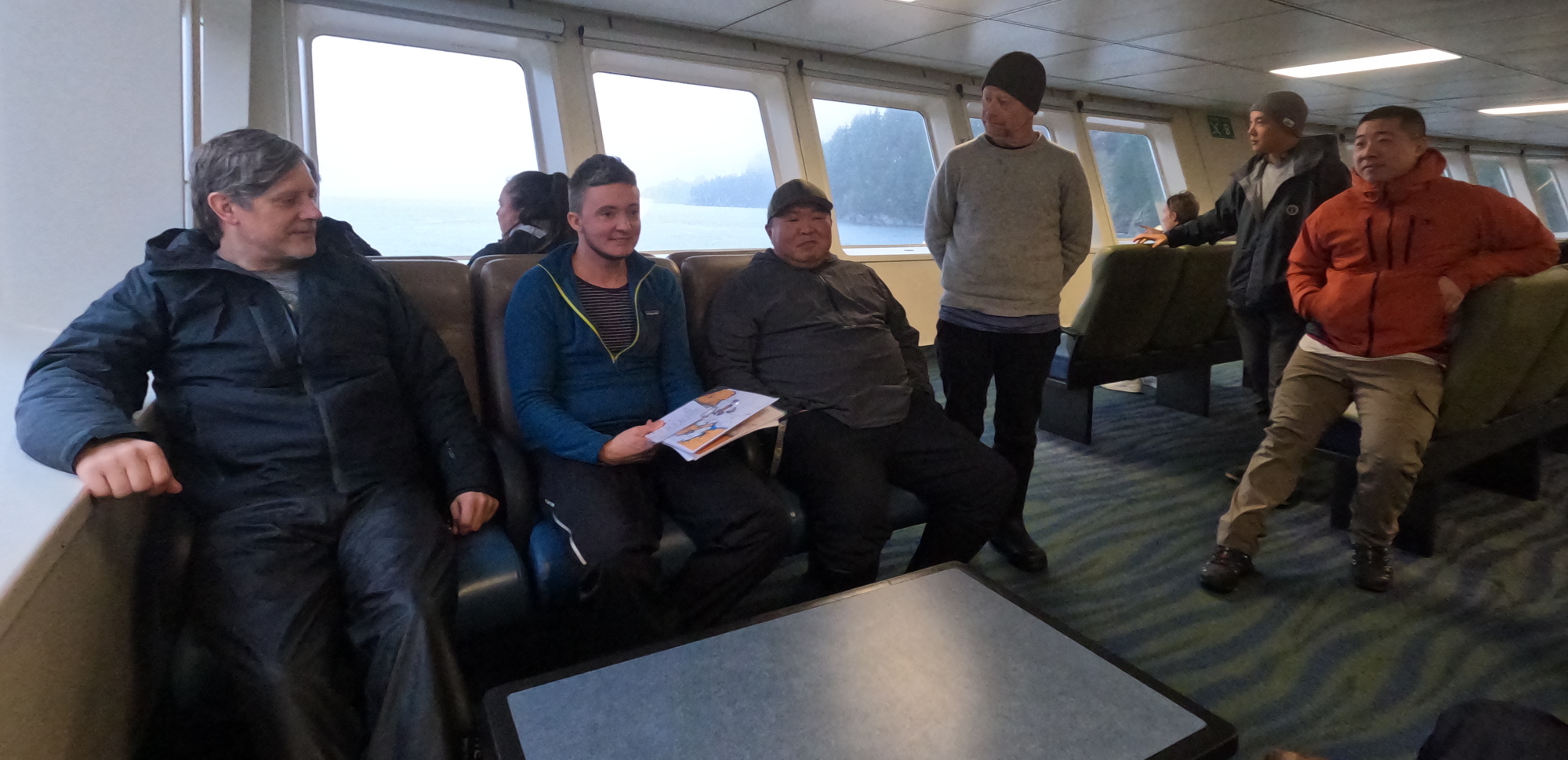
Our little car convoy made fine time to the Horsebay Ferry Terminal, and caught the 10AM something boat across to Nex̱wlélex̱wm/Bowen Island. Enroute, we had a quick huddle in the passenger lounge to confirm launching, the paddle plan and radio channels.

final pre-paddle briefing on the ferry

As if to reward us for our perseverance, the rain stopped just as we launched from Tunstall Bay at noon. On the cliffy south side of the bay, a frozen waterfall testified to the unseasonably cold weather of the previous week.

Ice, ice, baby! A frozen waterfall on the south side of Tunstall Bay
Enroute to Worlcombe Island

As we approached Worlcombe Island, we could see vast flocks of large birds gyring above the treetops. They proved not to be vultures lurking for under-prepared kayakers, but eagles young and old. (They’re clearly visible at this point in my buddy Mike’s video of our outing.)

Along the north side of Worlcombe Island

We alit a little after 1PM in a small bay at the southwest tip of Pasley Island. In summer, I wouldn’t bother firing up a stove for lunch, but in winter, it’s nice to stoke the inner fires with pre-warmed fuel. So my trusty WindBurner stove came into play. It was not only mucho fast but also provided much amusement for my tripmates, as the vast clouds of steam made it look like I was either improvising a sauna or preparing to do a magician’s disappearing act.

It being the offseason, the homes on the upland above our picnic spot were not occupied. This was fortunate, since it meant that those of us who lined up facing the southern rockwall to take the necessary pre-launch precautions to ensure our drysuits would remain dry for the next leg of the voyage were not accosted by irate cottagers. 

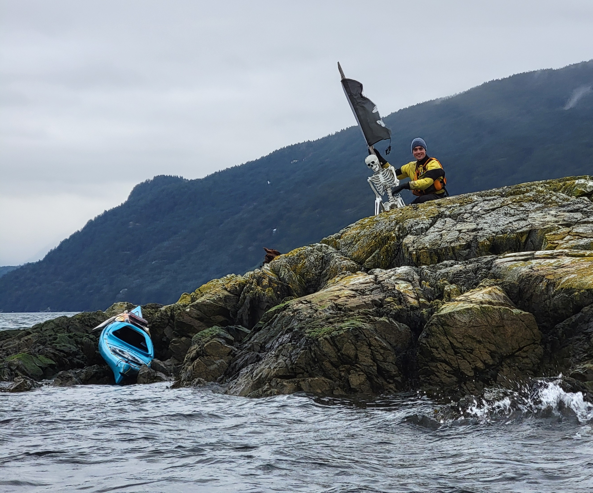
On an offshore rock near the northwest tip of Pasley, we spotted a bleached white skeleton. This was not a kayaker who’d been marooned by an insufficiently secured boat, but a brilliant bit of sculpture installed by an unknown artist for the delight of passing boaters. It even included an appropriately wind-tattered pirate flag.

Somewhere between our boney friend’s reef and Mickey Island, the rain began to fall intermittently. But it had held off for our lunch stop and was pretty tolerable while we were buttoned up in our boats and pumping out body heat with every stroke.

As we bobbed in the lee of Mickey Island, confirming our course home and who was leading the next leg of the trip (me, as it happened), swooping and diving seagulls just off the point on Pasley Island south of us showed something was afoot (or perhaps, afin). And as we got nearer, swirls and splashes from beneath the sea, like reversed raindrops, confirmed that fish were being herded up from below. Sure enough, enormous thick brown necks suddenly broke the surface, accompanied by huffs and snorts. (As an aside: I’ve been within paddle-poking distance of Orca more than once over the years, but I continue to be more wary of sealions than killer whales. Still, I comforted myself with the idea that if they decided they were tired of seafood and wanted a little red meat, the odds were only one in thirteen I’d be dinner!) The sealions are best visible at this mark in Mike’s video.

Switching leaders once more at the western tip of Worlcombe, we handrailed along its south shore, encountering more sealions on route. They proved pretty camera-shy, appearing only in the distance anytime I had my Go-Pro in hand.

along the south shore of Worlcombe Island

We landed back in Tunstall Bay a bit after 4PM, with a rain falling so steadily I opted not to change out of my drysuit, but to drive to the ferry terminal still wearing it.

The last of us rolled onto the five-something ferry just moments before it sailed, as if it were our own personal, private transportation. Upstairs in the passenger lounge, we ambushed one of our number, whose birthday it happened to be, with donuts and singing.

After offloading the boats back at Jericho Beach Kayak, we supped at the Wolf And Hound. It’s amazing how many of our adventures end there. It’s almost become our off-season office!

The fabulous thirteen!
a chart of Bowen Island and the Pasley Islands in Howe Sound, British Columbia, showing the route of our kayak daytrip
the route of our daytrip

Thanks to all my colleagues for the pleasure of their company, and to Mika, Chris, Natalie, Tomo, Warren, and EJ for sharing pictures for this post.

Going Paddleabout: Sea Kayaking around Bella Bella, BC (Part 2)

July 17th

View of a creek over the bow of sea kayak

Peering out of my tent after the alarm went off at 5AM, I could see wavelets even in the lee-sheltered little bay. I decided not to make the exposed crossing to Stirling Island with the seas already so stirred up. I rolled over to enjoy a lie-in.
I rewoke at 8AM, on time to bid Gerald good-bye as he left, and make a yummy pancake breakfast. I spent the day sight-seeing and exploring the archipelago northeast of Triquet Island, rewatering from a small creek in a Hunter Island bay. With the weird and random winds running through the channels , I got to sail in short bursts on both the outbound and return trips. Continue reading