

As I round the tip of Whitely Island into the long Pacific swell, the bow of my kayak lifts like the head of a stallion eager for rolling, open country after miles of narrow trails. The first leg of my solo paddle from Fair Harbour has run through sheltered channels, and my boat seems to welcome a greater challenge. As do I. For the past several hours, the weather has been what the Irish euphemistically call “soft”—meaning it has varied from gently curling mist to torrential downpours that have hissed on the surface of the water like oil on a hot frying pan. Now the clouds have parted, making the final hour of paddling to Rugged Point pleasantly dry.
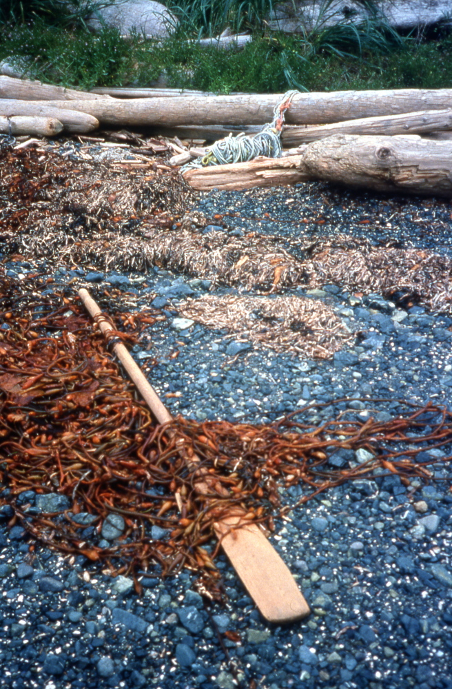
Since only the outermost end of Rugged Point is protected as a park, it sits as a small speartip of trees at the end of a long shaft of logging slash. There are truly magnificent beaches on the outer, western side. But even on windless days the surf spills steadily here. In any kind of blow, launching a kayak would be…sporty. So I opt for the small sheltered beaches on the inside.
Once ashore, my sneaking suspicions are confirmed: the water that has been pooling in my cockpit is not the result of a sprayskirt leaking in the rain. Instead, a slight side-to-side play in my seat has caused its lower front lip to saw through the hull, creating a porous groove on the bottom that lets seawater slowly seep through the floor. Fortunately, my field repair kit includes marine epoxy.
On the beach, I meet Bob, who’s travelling in a wonderful kayak he built himself from a design by noted kayaker and historian George Dyson. Although made of aluminum tubing, modern fabrics and coatings, the boat’s flowing clean lines are very true to the first kayaks crafted by the indigenous hunters of the Arctic. By comparison, I feel almost a fraud in my fibreglass and Kevlar craft.
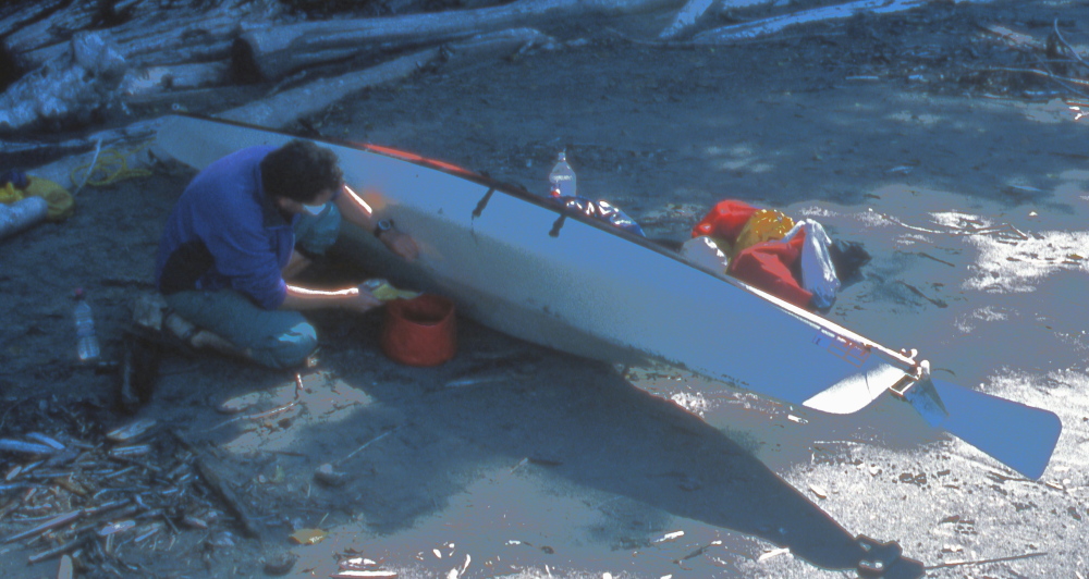
The next day, dry weather gives me the opportunity I need to repair my sea-steed. I carefully rinse away the salt with fresh water, then paint the epoxy into place inside and outside the boat. As it’s drying, I explore the beach. I find fresh bear tracks, but see no sign of the bear itself. I am only partially disappointed by that.

That night, each wave ignites with the green fire of bioluminescence as it crashes onto the beach. And, as always to city-dulled eyes, the stars burn through the clear night with startling brightness.
Careful sea trials the next morning confirm my repair is watertight. The sea is calm, allowing me to roam among the islets and rocks off Union Island as I make for Kyuquot Harbour. To the west, the open Pacific runs unbroken to the horizon, while to the east, the coastal peaks soar hundreds feet into the air. The water is a minefield of what kayakers wryly call “boomers”—rocks lurking just beneath the surface, revealed only when an exceptionally deep trough unmasks them. Or, worse, when an exceptionally high wave breaks over them. If you’re over one at the wrong moment—boom! As I manoeuvre trying to catch a photo of one such booby trap, I’m startled by a second rock suddenly unveiled just in front of my bow. Caveat kayaker.

Kyuquot Harbour is a tiny fishing community accessible only by boat. The single store offers groceries, hardware, and gossip, and opens for only two hours each day. It’s not like you can walk down the block to the competition.

Bob and a couple of his friends catch up with me as I eat lunch in the harbour, waiting for the store to open. Once we’ve scored some salty snacks from the store’s limited offerings, we detour up the creek at the north end of Clanninick Cove. After hours of the sun blasting from above and from reflections off the sea’s surface, the cool green sanctuary of Sitka spruce is very welcome. Only the quiet gurgle of our paddle strokes punctuates the silence.

We reach the Bunsby Islands in the early dusk. The silhouette of a landmark rock on the outside of Checkaklis Island is a sort of natural Rorschach test: while I see an Easter Island-like statue head in its seaward outline, others find the profile of a pregnant mother goddess on the landward side.

The area is rich with reminders of the Ka:’yu:’k’t’h’/Che:k’tles7et’h’ First Nations who have lived here for millennia. Although nothing remains of the fortress that once stood on Checkaklis Island, one can still stand on the western cliffs, gazing out over the Brooks Peninsula, and imagine watchmen standing on the same spot centuries ago.
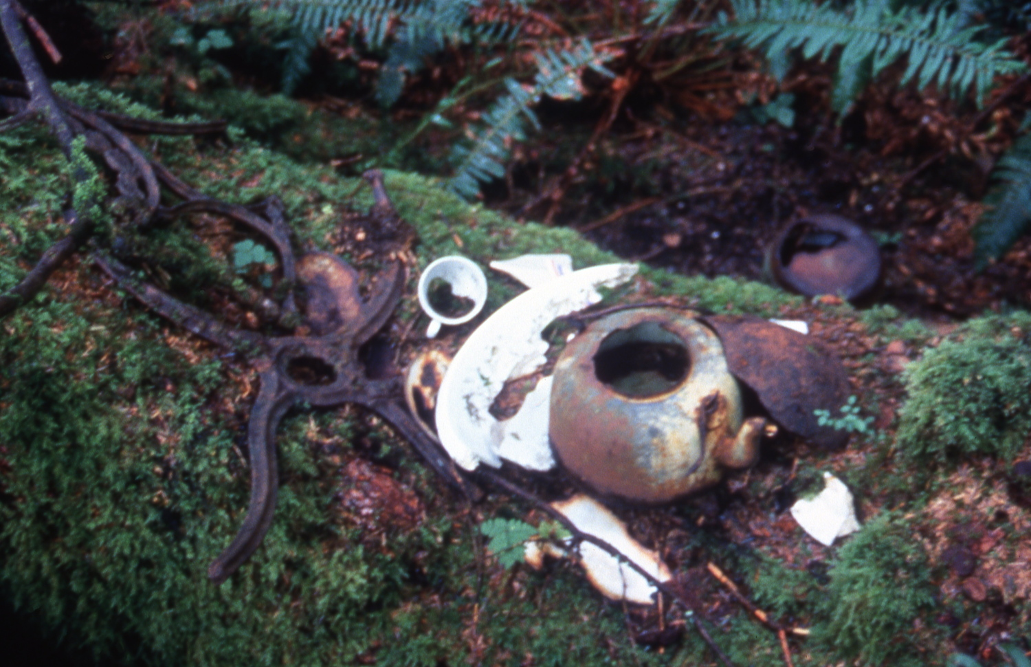
The next morning, Bob and co are up and launched early. I wave them a fond goodbye, but am happy to be on my own once more. On the mainland north of the Bunsbys I visit an ancient village site. The buildings have long since been absorbed back into the forest. Only broken crockery, rusted kettles, and a brooding totem pole remain.

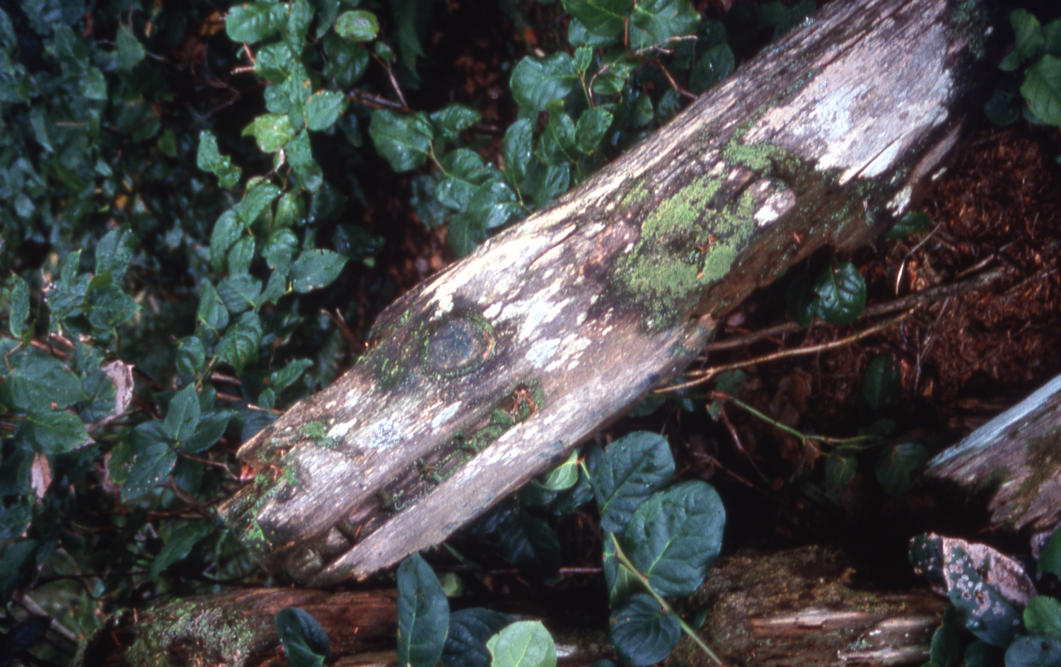
On a nearby island, the outlines of a burial canoe are so blurred by decay and moss that one would pass it by as just another fallen tree—if it were not for the skulls and bones scattered across it. Three raven feathers stuck upright among the bones bear witness to the fact that people still come to pay their respects. I walk as carefully as I would in any other cemetery, watching my steps to be sure I’m not treading on bones.


To those from non-native cultures, this kind of open-air burial seems curious at first. Who were these people? What were their names, and dates of birth and death? How did they die? How can we visualize them as persons without all that info? Upon reflection, several critical facts become obvious. Firstly, any family members would have all those details and more etched on their hearts. Secondly, nothing could be more personal than contemplating the skull of the deceased. Thirdly, letting a body be quickly reincorporated into nature seems more accepting of our “dust-to-dust” destiny than trying to delay the inevitable with metal coffins and elaborate crypts. I am glad the remains are undisturbed by visitors, and hope they will stay so.
The extent of logged areas has been tapering off as I move northward, and from the Bunsbys onward the coast is almost pristine. Where the swells permit landing, I paddle in to explore the many sea caves on the rocky shore.

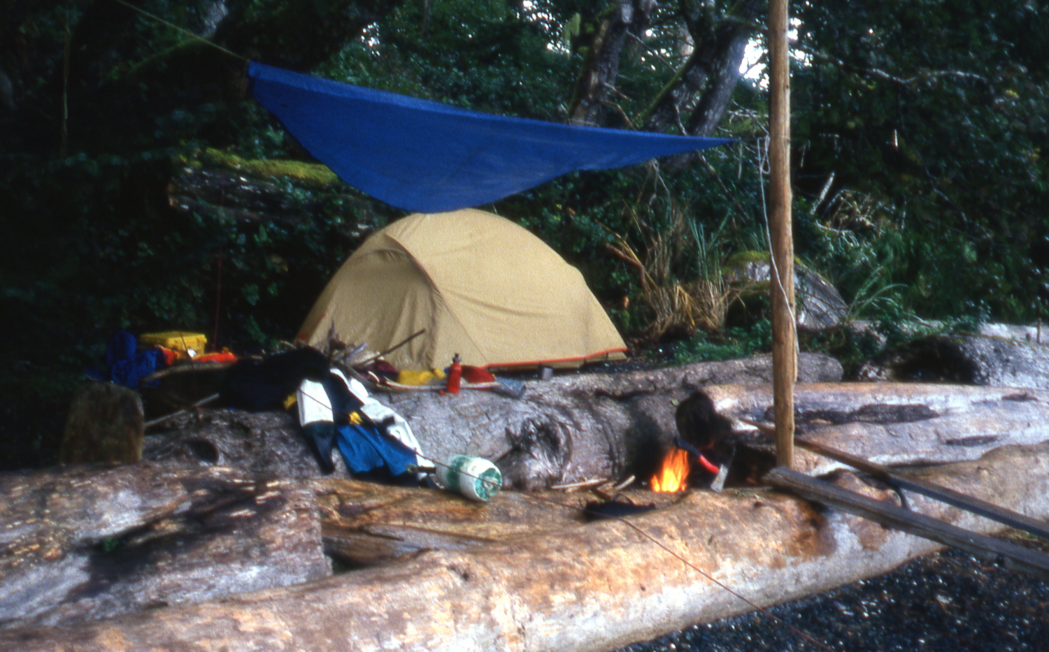
I camp that night on a pocket beach tucked unexpectedly on the outside of islands east of Ferry Rock. It has a gravel ledge just large enough for my tent and my campfire. The rain considerately holds off until I’ve pitched camp and gathered firewood, then settles into a steady drizzle that will last two days. Cosy under my tarp, I sip hot chocolate and listen to the boom of waves just outside my haven. At high tide, the last vestiges of those great swells sweep around the corner of the tor protecting my miniature harbour, and collapse on the shore like pilgrims exhausted by their thousand mile journey from the open Pacific.
During a brief lull in the wind, I make the crossing to the mouth of Johnson Lagoon, on the south side of the Brooks Peninsula. This three-mile long, half-mile wide inlet is protected by an entrance that narrows to just forty feet, so water boils in or out through this bottleneck much of the time. Even now, just an hour off slack tide, the current runs too swiftly for me to battle upstream.

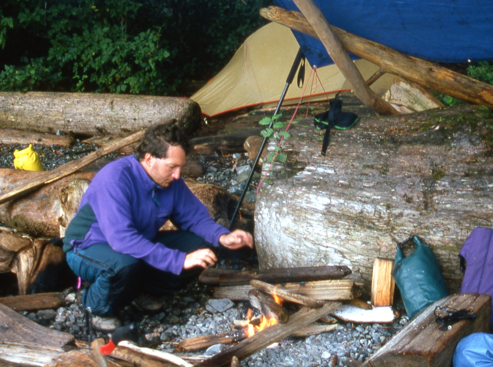
I paddle west along the coast to Jackobson Point, the waves rising steadily as I pass sheer cliffs rising out of the sea. By the time I am in the lee of the point, the weather has built up to a full gale. I take the presence of a wrecked fishing boat on the rocks as a warning from the sea gods and scurry into the beach. Again, I will wait two days while the storm blows itself out. Though the wind howls through the tree tops and massive seas fling themselves against the rocks just outside my sanctuary, only faint eddies stir the smoke of my campfire. More frequent storms are just the price I pay for paddling this popular area in the less crowded shoulder season.
Just as well I have such a secure bolthole: I caught a bug from Bob or one of his buddies before we parted, and it flowers into full phlegm now. I burrow into survival mode in my tent, nose stuffed, and shivering despite wearing every piece of fleece I have and zipping my sleeping bag into full mummy configuration. I’m very glad of my pocket radio, which in addition to weather channels, receives AM, FM and shortwave. Ordinarily, I spurn man-made noise while out in nature, but with my eyes too rheumy to read, listening is a welcome distraction. Roaming the airwaves, I stumble across the Coast to Coast AM talk show. When in my right mind, I’d have been simply irked by Art Bell’s credulous concoction of conspiracy theories and sightings of UFOs, ghosts, and Bigfoot. But with my brain oxygen-deprived and fever-addled, I am temporarily in his target demographic, and find it all vastly entertaining.
An important note: this trip happened more than a quarter of a century ago. Since then, awareness of the moral and legal rights of British Columbia’s First Nations to their unceded territories has vastly expanded, as have both their settled and pending land claims. Many of the sites described are no longer accessible for non-natives, or accessible only with the permission of their rightful owners, the Ka:’yu:’k’t’h’/Che:k:tles7et’h’ (sometimes simplified as Kyuquot/Cheklesath) First Nation. For the most up-to-date information on access, please visit: http://www.kyuquotbc.ca/. Another useful resource is BC Marine Trails.
The second part of this trip report is here.

Pingback: Paddling The Past: Solo Sea Kayaking Kyuquot Sound, September 1994 Part 2 | Kayakwriter's Blog