
A trip from a time before digital photography.
August 25, 1999 We awoke to a mix of blue sky and clouds, and no rain! With a forecast for 15 knot westerly winds, we made the decision to go for rounding Cape Scott today, and got launched about 9:45AM. Even as we crossed Experiment Bight, we could see foam from swells breaking on rocks north of Cape Scott.
Near the north of the cape, Stania was startled by a sea lion surfacing with an explosive snort just behind her. He torpedoed past our bows, glaring back as he paced us. Just then we noticed, in a kelp bed a couple of hundred feet away, the front flippers of numerous sleeping sea lions, presumably our escort’s harem. By this time we’d passed our closest point of approach to the ladies, so as much as one can tiptoe in a kayak, we tiptoed away, while trying to project soothing vibes to the effect of “We have no designs on your wives, lovely and blubbery though they all are, we’re sure.”
As we arced west of the cape’s most seaward point, we could see brown rocks and reefs flecked with foam. We also began to encounter the first really serious Pacific swells of the trip, at least two to three metres. It takes a little while to re-acclimatize to these moving mountains, especially when it’s been a year since you last paddled on the outer coast. Each swell is the height and shape of a house roof. You climb the face, then drop into the trough, where you are usually out of the wind, always out of sight of land, and often out of sight of your paddling partner.
Even here, more than a mile offshore, we could feel occasional counter swells heading back out sea after they had bounced off the cliffs. Sometimes in phase with the inbound swells, and sometimes out of phase, they created the confused seas so characteristic of clapotis.

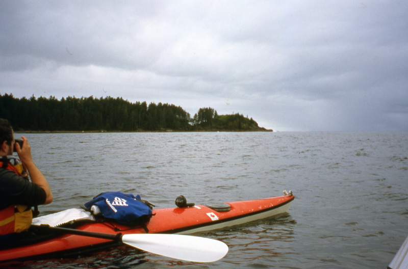
A note about the photos: the “big water” action shots are few and often blurry. At this time, there were no GoPros you could clamp to your deck and forget, or cigarette-pack sized, weathertight cameras you could draw and shoot faster than a Hollywood gunslinger. There were only bulky, slow-focusing film cameras with languid shutter speeds, that had to be wrestled from their waterproof prisons, given time to wind after every shot, and then restowed. You’ll understand why I wasn’t going to take an Ansel Adams approach to composition in 3-metre swells.

As we passed Guise Bay, we could see what appeared to be fog bearing down from the south. I had some apprehension that we might need to grope for the narrow entrance of Hansen Bay on “Instrument Flight Rules” (that is, purely by GPS).
Handheld GPSs of this era did not display your position on scrolling maps in real time; they just showed numerical latitudes and longitudes which you had to transpose onto your paper charts. (Those charts, in obedience to Murphy’s Law, were invariably folded in their mapcase in a such a way that the finer lat and long scales were obscured.) If you were simultaneously trying to transfer readings and keep your kayak upright in dodgy seas, you were busier than a one-armed wallpaper hanger in a tornado-riding house trailer.
I had pre-entered critical waypoints such as the mouth of Hansen Bay, so the GPS could point “as the crow flies” direct lines to them. What it could not do was show our current proximity to rocks, reefs and cliffs. I had a deck-mounted compass as well, but in fog, with wind and current twirling you unpredictably off course, it’s all too easy for deduced reckoning to unravel into literal dead reckoning.

Fortunately, the cloud proved to be only a wind and rain squall. It whipped up small white caps overlaying the existing swells, which made for quite a bouncy and sporty ride. However, once it was clear we would have sufficient visibility to locate Hansen Bay by Mark 1 Eyeball, I began to really enjoy paddling in large and lively seas. I set our course to pass to seaward of Strange Rock. We might have been able to sneak between it and the mainland, but I’d noticed we were getting sets of three larger and steeper than normal swells every so often. The rocky shallows between Strange and the shore seemed like a rather too exciting place to be when one of those freak sets hit.

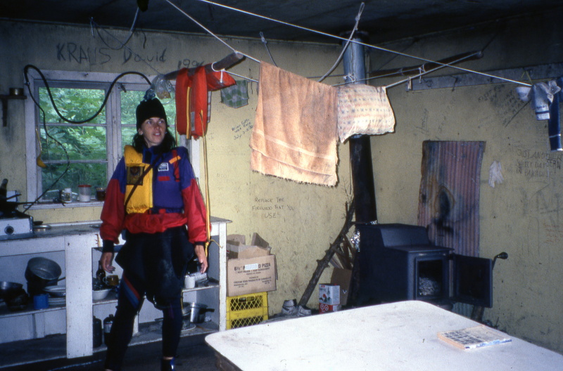
We slipped into the safety of Hansen Bay just after noon, both of us exhilarated by the chance to test our paddling skills. After lunch, we paddled up the lagoon. At the northeast end, next to a swiftly flowing river, we found an old cabin used by hikers. Many had scrawled names, dates, boasts and poems on the walls.

We paddled back to the neck of the bay to camp. In contrast to the wild waters without, the bay felt like a millpond. The rain kindly held off long enough for us to get our tents and tarp up. Wind funneling steadily along the inlet chilled me a bit as we prepared supper, but once my inner fires had been stoked with fried potatoes, onion and bacon, I warmed up.
I’m in the tent wrapped around a mug of peppermint tea as I write this. We won’t be able to paddle tomorrow as the forecast is 30 knot southeast winds. On the plus side, we’ll get to sleep in!
August 26, 1999 The wind blew strongly all day. With no particular reason to hurry, we did not have breakfast until 13:00 hours. I moved the tarp to a slightly more sheltered spot, and braced it with lines and driftwood log anchors. Fortunately the wind has been warm, and rather than driving rain, there’s only the occasional cloud of misty droplets. But it’s gusty enough that we’re getting cat’s paws even on the sheltered waters of the bay; what it must be like out on the open sea is hard to imagine.

Update: 21:15 hours. After going out to discover the tarp blown over even in its new “sheltered” location, I decided to stop being all Ozymandias, and moved it to a little grove in the woods, next to the creek where we’ve been getting water. At first I wasn’t sure it was worth doing, as we’d expected to be here for only two more meals (supper and breakfast). But with this evening’s forecast for 40 knot winds tomorrow (and possibly longer), we’re here for at least one more full day. We’re as much stormbound as mountaineers in a blizzard; to attempt travel would be to court death. But we’re much better off than climbers; we have the freedom to walk about outside, and to retreat to our tents when we need privacy or respite from the wind.
Though I’m frustrated by the prospect of another day or two stormbound, the lagoon and bay did look magnificently wild in the dusk. And it’s always a neat feeling to be camped where no lights or houses are visible.

August 27, 1999 Up at a semi-respectable hour: 8:00AM. Encouraged by patches of sunlight, we picked berries to add to our morning pancakes, and enjoyed them in the sheltered and sun-dappled kitchen by the stream.

The sky cleared fully later in the morning and we took advantage of it to do our laundry, dry our sleeping bags, and vent our tents. The wind continues to blow strongly enough to forbid leaving, but with the sunny skies, it feels less like an entrapment and more like a rather gusty day at the beach.
The forecast is for 45 knot winds and 4 metre seas tomorrow, but light to moderate variable winds on Sunday. So our plan for then is to be up early enough to be on the water at first light, and make our break for it in the Sunday morning calm.

For dinner, I baked pizza with mozzarella cheese (which had kept perfectly in its cheesecloth and paraffin wrapping), home dehydrated olives and mushrooms, and pepperoni (so full of preservatives it has not so much a shelf life as a half life.)
August 28, 1999 We had very strong gusts throughout the night. Though previous ski trips in winter storms had made me confident in my tent’s wind-worthiness, it was still difficult to sleep with the din. All night, a succession of rolling blasts moved through the trees to the southwest, followed a few seconds later by the tent walls thrumming like drumskins at a heavy metal concert.
In the middle of the night, I remembered I’d left the stove windshield and cooking pots out in our little kitchen; I quite expected them to be gone, but when I went down in the morning to heat water for a shower and shampoo, everything was undisturbed. As always, bathing even in cold weather was a surprisingly painless process when you have warm water.
About 11AM we made brunch: the last of the English muffins, cheddar (also preserved in cheesecloth and paraffin), tinned turkey and a bit of mayo, popped in the Outback Oven to make delicious melts, followed by bagels toasted in the frypan and smeared lavishly with cream cheese. (Good food is amazingly important on trips and even more so as a morale booster when you’re weatherbound.)
The wind dropped a bit later in the morning, but a listen to the lighthouse weather reports confirmed that the seas had not yet subsided, and were running at 3 metre swells topped with 2 foot wind waves. So we’re sticking to our plan of a dawn departure tomorrow.
We spent the afternoon buried in our respective books: Sophie’s World in Stania’s case, Against The Gods – The Remarkable Story Of Risk in mine. I know many of the historical figures Bernstein describes from other contexts, so it’s interesting to see them in a new light. His explanations of game theory and opportunity costs should offer me additional insights into the strategies “adopted” by genes and phenotypes when I return to Dawkin’s The Extended Phenotype.
Just after three o’clock, a small, single-rotor Coast Guard helicopter swept into the inlet, flying very low and obviously searching for something. We stood very still, making eye contact but deliberately not waving. After inspecting us and our camp (our kayaks were in view and clearly intact), they flew away.
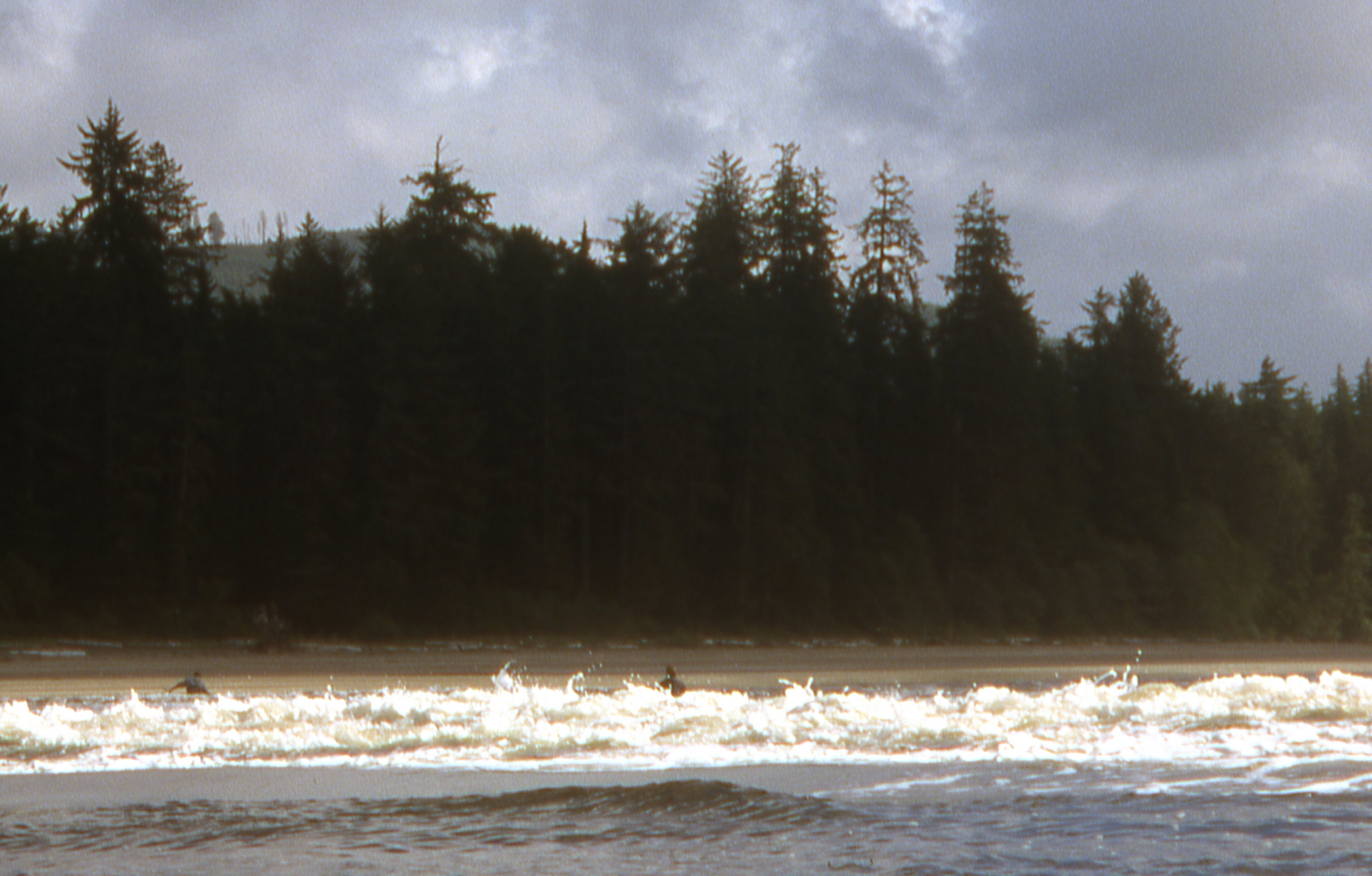
August 29, 1999 We’d set our alarms for 4:30, but we were so keyed up with anticipation that they weren’t needed. We ate and broke camp by headlamp, and launched at 6:45AM. Perfect timing: the cloudy dawn’s dim purple-grey glow was just enough to let us see what we were doing on the water. In the half-light, the incoming swells were huge and ghostly moving hills. Where they peaked in the narrow, shallow mouth of the inlet, we had to paddle aggressively to avoid being surfed backwards. Glancing to my left, I spotted a single sea otter bobbing in the waves, clearly puzzled about why we were in such a rush to leave the fun zone.

As we ran down to Cape Russell, the swells varied from 2 ½ to 3 ½ meters. For the first part of this leg, it was rain free yet cloudy. But about half way down Lowrie Bay, the sunlight shot through in a half wheel of spoke rays, creating an almost religious effect.
To the west, we spotted the distinctive red-and-white hull of a Coast Guard ship, presumably searching for whatever the helicopter had been looking for yesterday. However, they probably never saw us; we were very small targets, up sun from them, and hidden in troughs half the time.
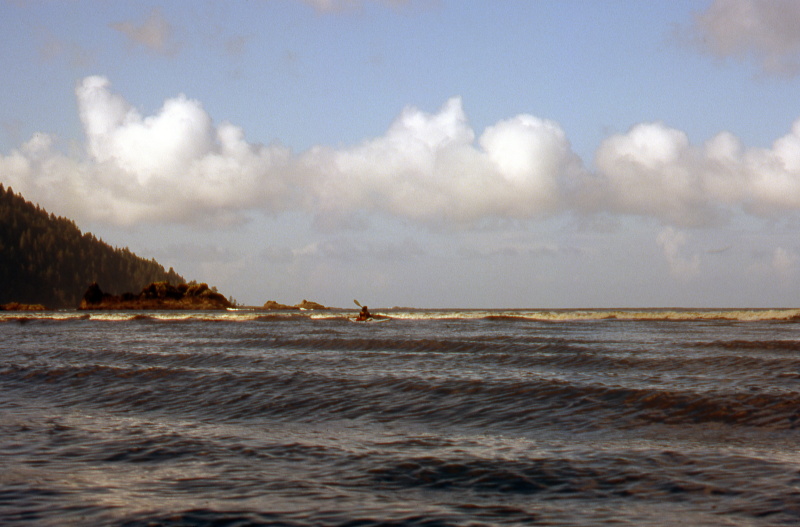
Rounding Cape Russell was one of two “crux moves” of the day. Hugh swells crashed impressively and intimidatingly over scattered rocks and reefs. One boomer in particular – the farthest to seaward from the Winnifred Islets – was especially worrisome. Only the largest swells would break over it, hurling up great gouts of foam like battleship gun shells bursting in the sea; the rest of the time it lay concealed like a predator in wait.
We prudently paddled a course of due South magnetic until we were sure we were well clear of it, then turned for the run into San Josef Bay. Then we had to adjust to taking the swells from astern; I backed off more than one big boy to avoid being surfed. Getting submarined or pitchpoled is all part of the fun when you’re playing in the surf zone with an empty whitewater boat, not so much with a sea kayak laden with cargo while you’re miles from shore.
About 10:00AM, we neared the mouth of the San Josef river, and the break zone formed by incoming swells tripping over the outflowing stream. Stania spotted two kayakers in small “puddle jumper” boats near the southwest end of the bay (they were the only other paddlers we saw during our entire trip.) I naively suggested to her that we should watch where they re-entered the break, on the theory they must have paddled out through it and picked the best line. “Or,” the more worldly Stania pointed out, “they might have piss-all idea what they’re doing.”
Moments later, her theory was upheld, and mine was overthrown – as were the two kayakers in the surf. We deliberately did not attempt to assist them; a loaded touring kayak tobogganing down a breaking wave is at best a semi-guided missile, and no-one needs one of those upside the head while swimming for shore.
Once we could see both swimmers standing safely in the shallows holding their boats, it was our turn. The good name of our expedition was at stake, so clearly we had to make a better showing than they had. I rejected several larger swells, then rode in on the crest of a smaller one. Only at the very last minute, just as the wave collapsed in the shallows, was I broached, but a low side brace kept me easily upright. Stania got pushed a bit further south of the river mouth, but moved back parallel with the surf, paddling when possible and bracing when needed. As we passed our two swimmer friends, we chatted with them long enough to discover that neither had ever seen a paddle brace before. Hmmmmmm, you don’t say?

We proceeded up the winding San Joseph river, a calm, green and cool contrast to the open seas we’d started on this morning. In places, the river was so shallow and swift that we simply lined our boats canoe-style, rather than wait for the incoming tide to raise the water level and reverse the current.
We reached the takeout and our car just before noon, ending a trip that encompassed all the elements of outer coast paddling: challenges, wild weather, amazing views, good food and great company.
“Paddling the outer coast is just like paddling the inner coast – only more so.“
The first part of this trip report is here

Pingback: Sea Kayaking Around Cape Scott, Part 1 | Kayakwriter's Blog