

rounding Kanaka Bluff
This series is a response to one reader’s request (It’s nice to know I have at least one reader!) They’re grab bags of trip suggestions and photos from many sea kayak voyages I’ve made through BC’s Gulf Islands over the course of more than two decades. I keep going back, not just because of the islands’ proximity to my home port of Vancouver, but also because they are richly served by a combination of National, Provincial and commercial water-accessible campgrounds.* By mixing up routes and seasons, you can create an infinite variety of voyages.
Have wheels, will travel
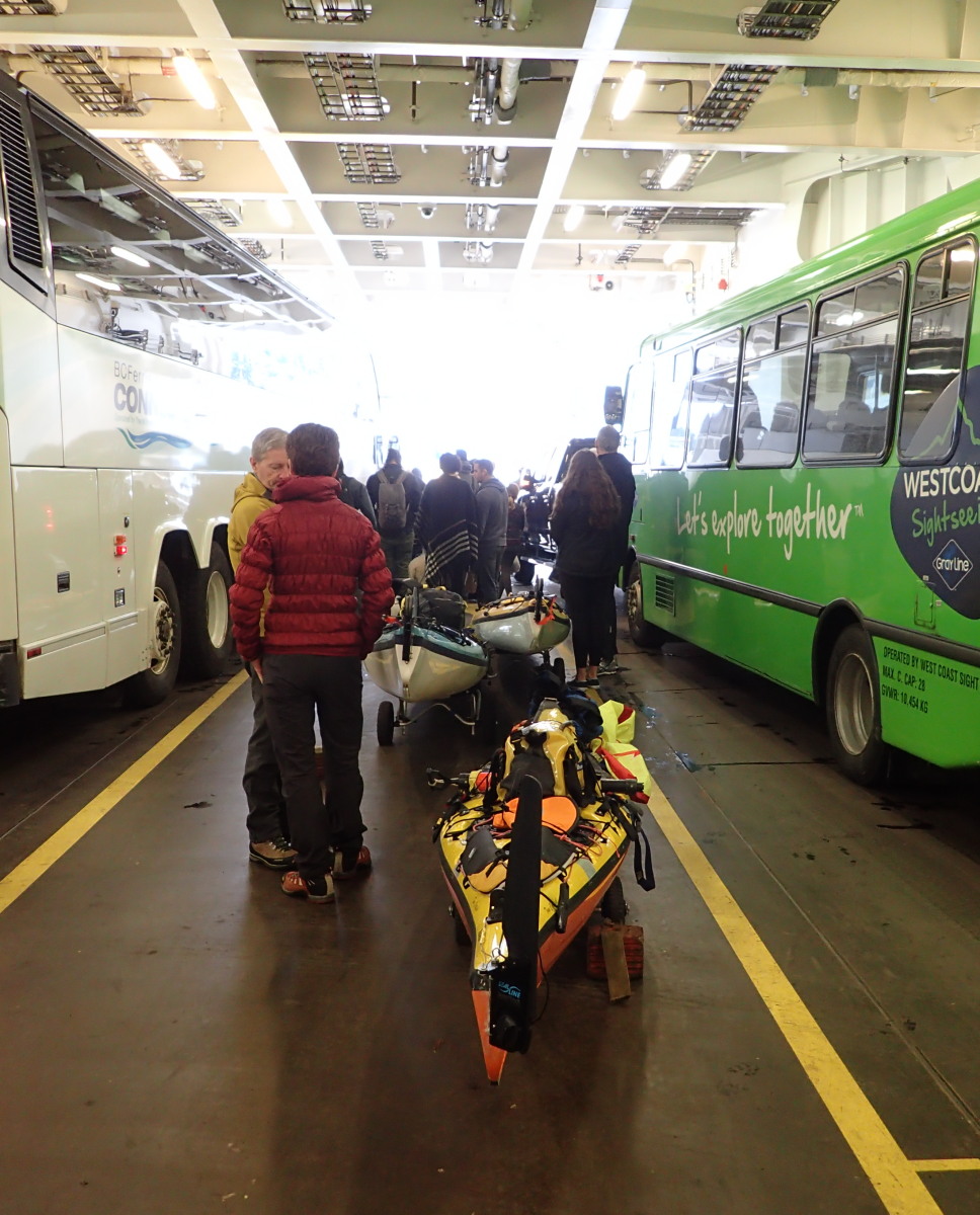
One piece of gear that will really open up your trip options is a set of take-apart kayak wheels. With these, you can park your car at one of the main BC ferries ports (Tsawwassen if you’re coming from the BC mainland, Swartz Bay if you’re on Vancouver Island), then simply wheel your kayak aboard the ferry as a foot passenger. Not only does this ensure you make your sailing even if the ferry is full to cars, it lets you do “open gate” trips, where you don’t need to paddle back to the BC ferries port you put in from. For example, you could wheel on board a ferry at Tsawwassen, take the ferry to Swartz Bay on Vancouver Island, paddle over and camp on Portland Island, then paddle to Village Bay on Mayne Island, where you can catch a ferry back to Tsawwassen.
 Since Swartz Bay is served by several ferry sailings a day from the mainland, let’s start our notional first trip there. Once your ferry has landed, wheel off the boat and up to the main restaurant building. Where the first leg of the red path is shown in the overhead picture, you will need to pass through a blue gate in the fencing. Ask someone at the BC ferries admin office, accessed at the south end of the restaurant building (indicated by the red arrow), to buzz you through the gate. Once through, head east on Dolphin Road, take the first left, and use the beach on the left of the public dock to launch. If your boats are light enough and/or you are strong enough, you can also carry your kayaks down the ramp onto the dock and launch there. (Sadly, things are less convenient if you have paddled into Swartz Bay to catch a ferry. You won’t be able to enter via the blue gate. You’ll have wheel west and then south along Dolphin Road to the ticket gates, adding several hundred meters to your portage. Do not attempt to land at the ferry docks here—it’s dangerous and illegal.)

The beach by the Swartz Bay public dock

Admiring the view of Saltspring Island from the trail around Portland Island
Portland Island, AKA Princess Margaret Island, is a great place for your first kayak camping outing. The Shell Beach and Princess Bay campsites are only about an hour’s paddle from Swartz Bay. The entire island is part of the Gulf Islands National Park Reserve, so there are no private homes. Or roads. Or cars. Instead, there is a hiking trail running around the entire perimeter of the island.
Arbutus Point at low tide
But my hands-down favourite campsite on Portland is Arbutus Point. So much to love about it. It’s just a 90 to 120 minute paddle from Swartz Bay. (If you’re confident in your night navigation and have the right lights, you can even catch a late Friday-after-work ferry over, and paddle to Portland in the dark. One of my most magical memories is of doing just this on a night when the bioluminescence was running strong. A pod of Orca crossed our path, setting up vast glowing green clouds in the sea.)
Arbutus Point has wonderful views through more than 180 degrees. On the mainland, Washington State’s Cascade Mountains, including Mount Baker, sprawl majestically.

Washington’s Cascade Mountains

Sunset from Arbutus Point

This is the point of camping, really.
The view towards towards Vancouver Island provides spectacular sunsets.

Along the Roe Lake trail

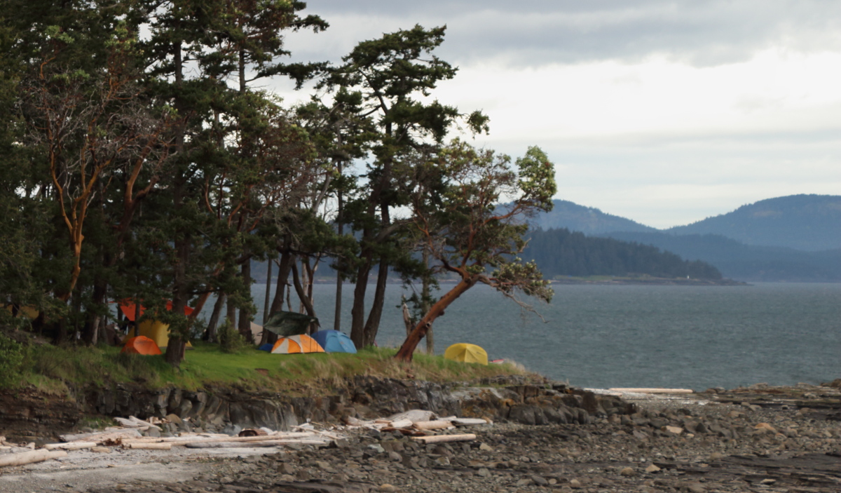
camping at Shingle Bay
The campground at Shingle Bay on North Pender island is not as sprawling or pretty as Portland Island, but it does offer very sheltered landing and launching, plus easy access to the Roe Lake Trail. Though it runs very near housing developments, the trail is cunningly routed to avoid urban sights and sounds, so it retains a quiet, pastoral feel.
 Shingle Bay is also very near the Otter Bay BC ferry terminal, which is handy for starting or finishing a trip—with one major caveat: you cannot launch or land at the ferry terminal itself. The nearest put-in/take-out is at Otter Bay Marina. They will charge you a few bucks for launching or landing, but you’ll also have access to groceries, baked goods and showers (especially nice if you’re not feeling up to sniff for civilized society after an extended camping trip). The challenges are the steep road up from the ferry terminal and from the main road down to the Marina (the latter is so steep that when I went down it solo I was seriously afraid of losing control of my wheeled kayak. I wound up looping my rescue throwline around a signpost, clipping it into to the kayak bow, and lowering the boat on wheels down the slope like a rock climber rappels a gear bag.)

a possible trip itinerary using the places described in this posting
* The best, and most up-to-date, resource for water-accessible campgrounds here, or anywhere else on the BC coast, is the map on the BC Marine Trails website. You can use the map for free, but why not join the BCMTN? For $25 a year, you’ll not only turn off the auto-beg pop-up, you’ll be supporting a very worthwhile organization.

Philip I enjoyed reading your write up on the Gulf Islands. Lot’s of good info on access points and campsites. I encourage you to share it on the Inside Passage Sea Kayakers Facebook page. Thanks Denis
Get Outlook for Android
________________________________
LikeLike
Thanks Dennis. Will do. Philip
LikeLike
At Swartz Bay, I find it very convenient to wheel down the ramp from the pier to the dock – and launch from the dock: It’s all down hill, so the cart wheels itself and the dock is a nice clean staging area to get all set up before starting. Depending on preference, one can slide the kayak off the dock or maneuver the kayak and cart perpendicular to the dock edge and just slide the kayak off the cart.
So that’s another option if the bank down to the beach is too difficult to maneuver. Thanks for another great article.
-mick
LikeLike