August 10
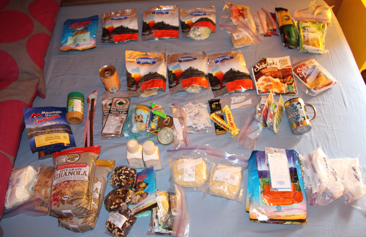
trip provisions laid out on the bed
We’d spent four lovely days at the Paddler’s Inn on Gilford Island in the Broughton Archipelago. It was our second time there, and we can’t recommend it enough – Bruce and Josée go out of their way to make you feel at home. But today my wife got on Bruce’s boat for the ride back to Telegraph Cove and the car; I slipped my kayak in the water to paddle southward.

Ready to launch

This abandoned cabin at the water’s edge made me wonder about the owner’s life story.
 My first day’s travel took me through Tribune Channel in an arc over the north and east sides of Gilford Island. It was one of the few days on my trip both wind and current were steadily with me — I even got to sail for a short time. As I’d hoped, I made the campsite just inside Kumlah Island for the first night. Supper was pretty fancy: fried strips of a steak that had kept by being frozen at the Paddler’s Inn, accompanied by instant mashed potatoes.
 August 11
A brutal launch on a falling tide, through sunken trees covered in barnacles and oysters. I paddled through low cloud for the first part of the morning, then had to battle a strong wind and white caps on the starboard quarter as I crossed Knight Inlet to Minstrel Island. I also discovered my sprayskirt, which had served me faithfully for many years, had chosen now to starting leaking through the seam joining deck and tunnel. I shipped an inch or so of water, but fortunately had my electric pump if the flooding had become destabilizing.

The campsite on Dorman Island suggested in The Wild Coast 3 looked brutal of access at this stage of the tide, and a bit gloomy, so I backtracked to a midden I’d noticed on the north side of The Blow Hole between Minstrel Island and East Cracroft Island. A few minutes work with my handsaw (the area had already been logged) cleared a site for my tiny tent.
Repeated showers drifted across my camp. Like the quality of mercy, they were not strained, but dropped from heaven as a gentle rain. Within, all was cosy, and I gazed up at the roof as I nodded off, listening to the light patter, and remembering all the nights and places this tent had sheltered me over the years.


August 12
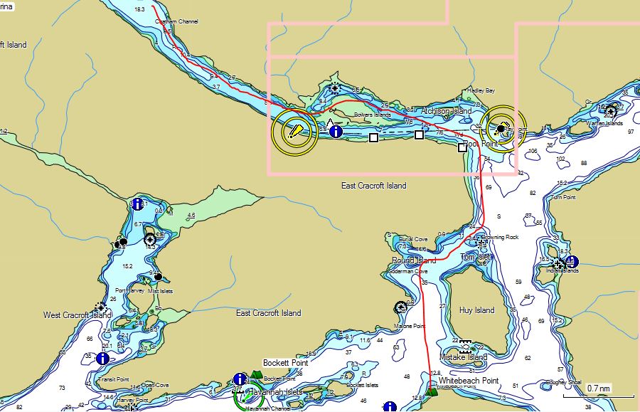
Another brutal launch through nature’s own razor wire ̶ rocks and sunken trees covered in oysters. I got to the tidal rapids at the S/E end of Chatham Channel ridiculously early, and had to wait three hours for them to turn my way. This was the first of several tidal “gates” on my route. I’d paddled directly from Port Hardy to Vancouver before via the big, wide Johnstone Strait, but this time I wanted to see new places, so I was taking the back channels, literally. It was certainly more interesting to wend my way through the islands, but it meant that at several locations, tidal rapids would bar my way until I could enter them at slack water with the coming ebb or flood heading the way I wanted to go.
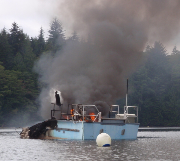 As I paddled past the appropriately named Burial Cove, I spotted a boat on fire. A fishing guide in a runabout suggested this was simply some local’s way of disposing of a no-longer wanted vessel. (Environmental regulations sometimes are more of an urban theory than a reality in the backcountry.)
Soon afterwards, I landed at one of the prettiest camps of the trip, the shell midden at Whitebeach Point.

August 13
The launch down the clean, steep beach was the easiest so far, and the day started off with low cloud and calm waters. A Great Blue Heron reluctantly took off and flew down the shoreline ahead of me, squawking loudly — presumably a complaint that I was spooking the fish.

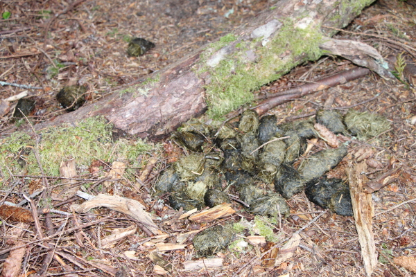
By noon, I was fighting both countercurrents and headwinds as I made my way east along the north side of Johnstone Strait. By the time I reached Blenkinsop Bay in the early evening , I was tired and felt I’d done a fair day’s work. The land around the bay had been logged, but it had a sandy beach, a border of trees and upland camping (nice during this near full moon period of spring tides). It wasn’t until after I’d unloaded all my gear and begun to explore that I found fresh bear tracks and scat.

I waffled. I have a history with bears, and I had promised my wife I’d be especially careful on this trip. Prudence suggested it wasn’t smart to camp in an area with fresh bear sign. But I had little energy and couldn’t remember any alternate site nearby. The solution turned up literally at my feet: a lost map case on the beach, with a campsite indicated on nearby Yorke Island. I’d had it marked on my own map and entered in my GPS, but it had been hidden by a fold in my chart and a lapse in my memory.

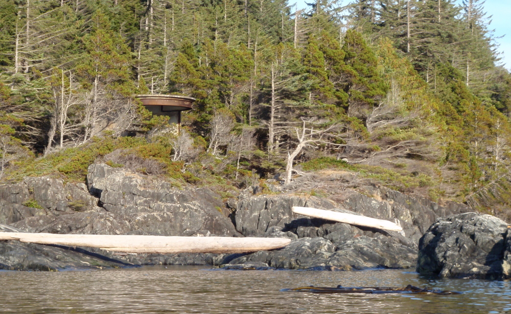 I set out in the evening calm, not encountering any of the tide rips shown between the bay and Yorke Island (though there were some good eddies and upwellings in the shallow waters between Fanny, Clarence and Yorke islands). On a point at the N/W end of Yorke, I spotted a gun emplacement left over from the WWII installation there. As I drifted round the point, I nearly ran down a pair of seals, who promptly crash-dived.

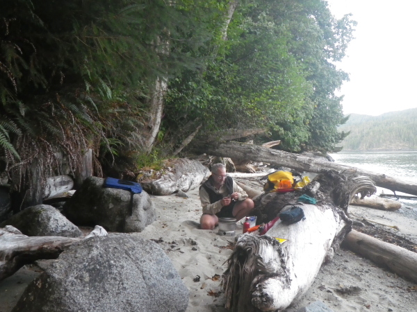
Even with the aid of the GPS, I only just found the well-concealed landing site. Soon I had my tent set up well above the tide on a flat, grassy upland, and was eating freeze dried Cuban Coconut Rice and Black Beans (hearty peasant food) in the dusk, floating in that sweet, contented trance that comes from hard work and knowing you have a safe camp for the night and a rest day tomorrow. And I had dodged any bears. At least for now.

The second part of this trip report is here.

Excellent as usual. Nice imagery here: “Another brutal launch through nature’s own razor wire ̶ rocks and sunken trees covered in oysters.”
LikeLike